

Isorno-Trail

Description
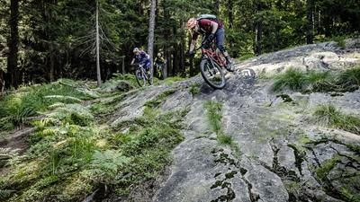
The start of the Isorno Trail is in Pontetto, a little north of Domodossola. Take a little-used mountain road up to Altoggio and then follow the road into the Valle dell'Isorno. On this section, the route for the return journey can be seen on the opposite side of the valley. This begins at a small dam near the village of Corte Sapa and rides through the wild landscape of the Isorno valley. A small railroad once ran along this path to the water tunnel at Aulogna. This railroad no longer rides today, but the tracks are still there and the many railroad sleepers make the path correspondingly bumpy. The descent into the Isorno gorge begins in Aulogna. Initially, the path is good and easy to ride, but then becomes increasingly challenging further down. Finally, you reach the bridge on the valley floor and then climb 100 meters in altitude on the opposite side to the edge of the forest at Altoggio. The bike has to be pushed on this ascent. A fast and agile path later leads down to Chiesa and from there on to Pontemaglio. The return trip to Pontetto rides along the River Toce and is a wonderfully varied mix of flowing trails and sections on gravel roads.
Map & GPX-Track
The map is only available to Ride subscribers.
The Ride-Subscription is available at ride-mtb.com/abo
.
Details of the tour
27 km
1000 m
1000 m
298 above sea level
1039 above sea level
1 day
Pontetto-Roldo
Pontetto-Roldo
1524
not suitable
More tours nearby







User comments (6)

About the author: Thomas Giger
Note: This content has been automatically translated from German. Please report any incorrect translations.
We rode the route today. The description and comments are all accurate. For me, the “Bachbett Trail” wasn’t rideable. I don’t like pushing my bike uphill and downhill. Be sure to bring plenty of food. We didn’t find any restaurants open along the way. I almost passed out because I hadn’t eaten enough.
Rode the route today (July 11, 2026). To get to the start of the railroad track, it’s better not to stay on the asphalt a bit further and instead ride down the gravel path to the “reservoir.” The path in the GPX file is very overgrown. The railroad track is fun to ride—only rarely overgrown. The descent to Ponte has been cut through and cleared. About 100 meters in a stream bed are difficult to ride. Otherwise, the difficulty ranges between S1 and S3.
The rest is as described. Cool ride!
Check February 2026 – still not much snow at the very back of Corta Sapa, tracks are super cool – descent into the stream bed afterwards is rather tricky and full of thorny bushes! If you don't mind a bit of wilderness and adventure, you'll be rewarded with a flowing section afterwards! Beautiful spring tour!
Rode on 4/20/2014.
I was alone (in the whole valley😜).
No vegetation yet, so easy to ride.
The last 100 m down to Isorno is a stream bed, not rideable for me. The 2nd part from Altoggio is very nice and flowy. Compensates for the descent/ascent to Isorno
Dangers 06.06.2022: Rail route very overgrown in places, but mostly rideable. Descent into the gorge very overgrown (ferns sometimes as high as a man) and washed out. The descent to the bridge on the valley floor resembles a stream bed and is also overgrown. In my opinion, you can't ride this at the moment - even with the appropriate skills - because you can't see where you're going due to the lush vegetation. If you don't like snakes, you should avoid the path. I encountered 3 snakes, one of which snaked over my MTB shoe.
Detailed description of the conditions incl. photos here: https://www.gipfelbuch.ch/gipfelbuch/detail/id/125481
I rode the tour back in the fall, then without vegetation problems. Thanks for the tip! So a tour for early in the year or in the fall.