

Singletrail Map lowers prices
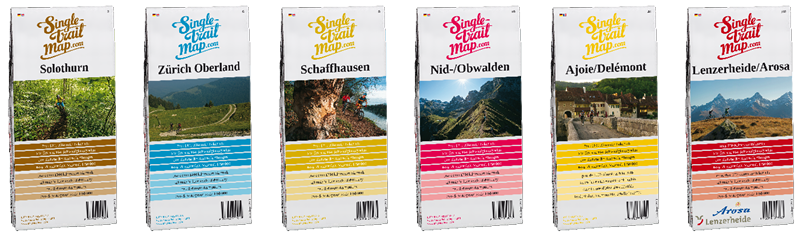
With the launch of the "Singletrail Maps" 15 years ago, the map producers led by initiator Thomas Giger achieved a pioneering feat. It was the first time that mountain bike trails were comprehensively recorded and transferred to maps. To this day, the core of the maps is a uniform and coherent route network that allows users to put together their own individual tours. The "Singletrail Maps" now consist of 44 map sheets, forming the world's largest contiguous network of mountain bike maps.
"We are now building on the pioneering spirit of the early years," says Giger about the new launch of the Singletrail Maps. In his view, the freely accessible data from Openstreetmap is the map basis of the future, and the company has now calculated its own map image. This not only saves the Singletrail Maps enormous licensing costs, but also means they can now access a uniform map image worldwide.
For the time being, seven map sheets are based on the new map base. All singletrail maps will be reprinted by the end of the year. The price reduction from CHF 25.00 to CHF 18.50 applies to the entire range. The new Singletrail Maps will be presented for the first time at the Bike Days in Solothurn. Switzerland's biggest bike festival starts today, Friday, and runs until Sunday evening (May 8-10, 2015).With the new map image, the Singletrail Maps logo has also been redesigned. However, the map content remains the same: the route network is divided into four different levels of difficulty (easy-medium-difficult-extreme), and the type of trail (single trail-gravel path-asphalt road) is also recognizable. Each map sheet also contains a detailed description of the ten most beautiful tours in the region. All content is bilingual in German and English, French or Italian.
Order Maps:
Map sheets with the new map base:
Map sheet 002: Solothurn
Map sheet 006: Zurich Oberland
Map sheet 008: Schaffhausen
Map sheet 010: Nid/Obwalden
Map sheet 034: Brig/Visp
Map sheet 044: Ajoie/Delémont
Map sheet 102: Lenzerheide
Publisher:
Swiss Sports Publishing GmbH
Clavadelerstrasse 3
7270 Davos Platz
Tel +41 81 413 43 43
info@sports-publishing.ch
Note: This content has been automatically translated from German. Please report any incorrect translations.