

Strada de la Vena (Alleghe)

Description
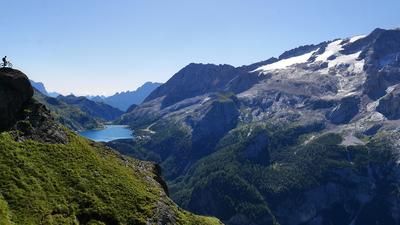
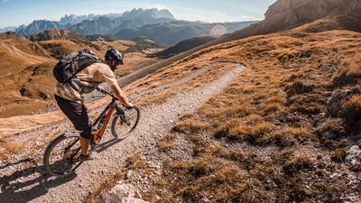
The first thing you do in Alleghe is get on the gondola and be shuttled up to the Col dei Baldi. This starts the tour with a descent, which may not be very spectacular, but at least it saves you 400 meters in altitude that you would otherwise have to pedal up on the pass road. The descent down to Pesoul is fast, flowing and a mix of gravel roads and single trails. In Pesoul, you roll down the valley a little on the road until the long ascent to Rifugio Fedare finally begins at Selva. The start is on a gravel road, followed by a road that winds its way up the mountain bend by bend. The road leads up to Passo Giau, but we turn off at Rifugio Fedare and take the chairlift up to Forcella Nuvolau. Up here, we take a break at the Rifugio Averau amidst the mighty Dolomite rock towers - before setting off on the long descent down to Caprile. For this, you initially head a few meters along a gravel road, but then take the first trail on the right and follow this super-fun path down to the meadowy plateau. Now keep right again and head down into the forest on a fast and flowing path. Continue along this path as it widens with increasing distance. Finally, at Col di Larzonai, you reach the Strada de la Vena, a historic access route for the former ore mines further back. The route continues to ride primarily on gravel roads until you reach the final bouquet of trails below Colcuc. An agile super trail leads down to Caprile and makes you forget the somewhat excessive forest road section of the tour. From Caprile, you roll along the cycle path back to Alleghe.
Note:
- The cable cars in Alleghe and the chairlift to Forcella Nuvolau are in operation from the beginning of July to mid-September.
- In autumn 2018, there was considerable storm damage in the region. Except for the last section from Colcuc to Caprile, the tour is well maintained. This last section was impassable during the summer of 2019, but should be passable again in the 2020 season.
Map & GPX-Track
The map is only available to Ride subscribers.
The Ride-Subscription is available at ride-mtb.com/abo
.
Details of the tour
38 km
875 m
2220 m
968 above sea level
2421 above sea level
1 day
Alleghe
Alleghe
1800
well suited
More information
Video
More tours nearby




User comments (0)

About the author: Thomas Giger
Note: This content has been automatically translated from German. Please report any incorrect translations.