

La Dôle
Description
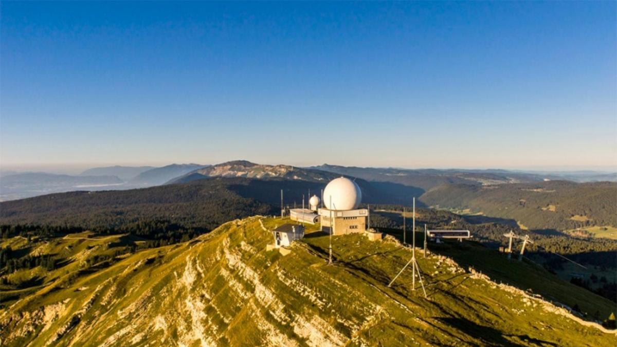
In Nyon, take the regional train to la Cure and then get off at Les Pralies. That's 800 meters in altitude already done, but the climb to the summit of La Dôle is still a tough one. First you descend a little to La St-Cergue and then climb up a small road to Alp Vuarne. From here, the path becomes rougher, but is still easy to ride. Until a hiking trail branches off to the right. You push your bike along this to a hill right at the foot of the La Dôle rock band, and finally you carry your bike up to the summit with its white dome. The panorama from up here of Lake Geneva, the Alps with Mont Blanc in the center and the Jura in the opposite direction is simply fantastic. Now it's time for the descent. Follow the trail along the ridge, but then soon bear left to reach Alp Portraux. Here the trail is not always clearly recognizable and gets lost on short sections in the meadowy terrain. After the alp, however, things are clearer. The route now rides along a first-class winding trail to Le Bauloz and then takes a fairly direct route to Bonmot. Here, first-class singletrail sections alternate with short connecting sections on gravel roads. From Bonmot, you then reach Nyon through the vast farmland on country roads.
Map & GPX-Track
The map is only available to Ride subscribers.
The Ride-Subscription is available at ride-mtb.com/abo
.
Details of the tour
27 km
610 m
1380 m
394 above sea level
1655 above sea level
1 day
Saint-Cergue
Saint-Cergue
1516
not suitable
User comments (4)

About the author: Thomas Giger
Note: This content has been automatically translated from German. Please report any incorrect translations.
Alternative route starting from La Givrine as mentioned above recommended, pushing and carrying passages only short.
The descent is also as described above. Initially a little rough over the ridge, but then mostly very flowy singletrail down to the bottom.
A very rewarding tour!
Corrigendum: Do the tour as described in Alain Gabarell's comment on 30.8.20.
La Dôle" is really amazing!
If you don't want to push/carry so much, you can also take the train to "La Givrine" and ascend via "La Trélasse" and "Couvaloup de Crans" from the northwest over the ski slopes.
The tour is therefore also suitable for e-bikes! (done 2 times last week)
Alternative for the descent: instead of turning left via "Potraux", go straight on via "Col de Combe Blanche" - "La Petite Grand" - "Le Portail" and then straight down to "camping Divonne" 100% singletrail
Awesome trail down on the French side—varied and fun. Thanks for the tip, Alain! We stayed on the Ride Route all the way down to Potraux (the hidden trail next to the wall is partly dark red but very beautiful) and from there took the turnoff next to the stable to Baudichonne, then turned right up to the pass and left across to Le Grand and Le Petit. Unfortunately, the Potraux cross-country trail is currently being downgraded to a gravel road. On the ascent, it’s worth pushing (and occasionally carrying your bike for short stretches) from 1,407 meters above sea level above Vuarne on the Ride Route because of the views of the rocks, including chamois. Coming from the north, you might find yourself pedaling through crowds of hikers on pure gravel trails almost all the way to the top—it’s a matter of personal preference.