

Grosse Isartrails-Runde

Description
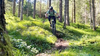
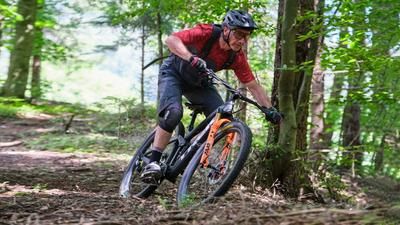
You start at Munich Zoo or beforehand at the German Museum and then follow the cycle path along the Isar. That's the beauty of Munich, you can start from any corner of the city and simply ride along the banks of the Isar and then upstream to the zoo. Shortly after the zoo, the trail starts on the left. It is always up and down, depending on the condition of the trail, you have to find your way. When it rains, it regularly becomes a muddy mess. At the Großhesseloherbrücke bridge, the route briefly follows the gravel cycle path and then immediately turns left onto the trail. Rooty, somewhat technical but not very difficult if you are fast enough, momentum is everything on these trails! This is how it goes until the Grünwalderbrücke bridge, then you switch to the other side of the Isar for the return trip on the eastern bank.
To do this, turn left onto the tarred road and then immediately right up onto the next trail. This is followed by a few steeper and longer climbs until you briefly meet the Wolfratshauser road on the high bank near Buchenhain. Now a beautiful downhill awaits, which is long and fast by Isar standards. The route descends rapidly back down to the Isar. At the bottom of the forest road, continue riding to the right until you turn left onto a small trail in Hochschäftlarn. A built trail begins at the edge of the high bank, which leads through fast banked turns back down to the main trail. After 500 meters, turn right down to the dam and ride along it to the bridge and over to the other side of the bank. A small trail immediately starts to climb steeply uphill, not too difficult, the trail winds up and down until you return to the tarred road to the Gasthof zur Mühle inn in a northerly direction. You can take a short break at the inn. After the inn, turn right onto the trail and keep left. The trail has some loamy passages and requires some riding technique. Rooty, sometimes steeply uphill and steeply downhill to the Grünwalderbrücke bridge, ride over it and turn right onto the path. Now come a few faster, wider trails. It is a constant up and down. Trail, then asphalt cycle path, then trail again. Before the Großhesselloher bridge, the trail climbs quite steeply to the high bank. Once you reach the top, you can take a short break at the Isarfräulein kiosk and then ride over the bridge, back down onto the trails of the approach and back to the zoo.
Map & GPX-Track
The map is only available to Ride subscribers.
The Ride-Subscription is available at ride-mtb.com/abo
.
Details of the tour
40 km
585 m
585 m
523 above sea level
666 above sea level
1 day
München
München
2342
well suited
More information
More tours nearby

User comments (0)
Background to Ride MTB
Ride MTB is dedicated to mountain biking. With the maps Ride Trail Maps and Trail Books and the print magazine Ride, it has played a formative role in alpine mountain biking for many years and has shaped it like few other organizations.
In addition to the publishing business, the company is now also active in product management and operating entire mountain bike projects. These include the tourism project Ride Travel and the development of modern and authentic mountain bike offers such as the Bahnentour in Davos Klosters, Engadin St. Moritz, Lenzerheide or Aletsch, as well as the creation of multi-day tours such as the Postauto-Tour or the Hüttentour.
Ride MTB GmbH was founded in 2001 (formerly Swiss Sports Publishing GmbH) and has been owned and managed by Thomas Giger since then.
Publishing and editorial address
Ride MTB GmbH
Falladagasse 11
CH-7212 Seewis
+41 81 413 43 43
info@ride-mtb.com
Subscription management
Advertisements
Administration
Bank details: Graubündner Kantonalbank.
CHF account. IBAN: CH86 0077 4010 2958 8310 1, BIC: GRKBCH2270A
EUR account. IBAN: CH32 0077 4010 2958 8310 3, BIC: GRKBCH2270A
Company identification number (UID): CHE-102.170.292
The brains behind Ride MTB










Note: This content has been automatically translated from German. Please report any incorrect translations.