

Rifugio Giaf

Description
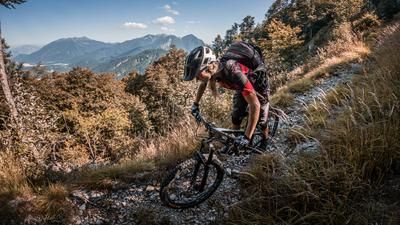
The loop begins just east of Forni di Sopra at the parking lot near the Dolomiti Ski Bar. From here, the route heads west along the Tagliamento, one of the last unregulated Alpine rivers, and then continues along the Torrente Giaf on a gravel path. With moderate to steep gradients, you pedal steadily uphill to the Rifugio Giaf at over 1,400 meters above sea level. You can stop for a break at the Rifugio Giaf before continuing in a cross-country style, alternating between pedaling and pushing, toward the Passo Mauria. The rideable sections are rated S2 and, typical of this region, run on classic limestone and forest floor with a Dolomite flair.
On the ridge itself, take the turnoff known as the “Stalinov Trail” toward Tagliamento. This offers smooth, rideable sections entirely on forest floor interspersed with root sections; however, due to the ground conditions, this ride should ideally be done in dry weather. In summary, the trail is rated S2 in difficulty and joins the farm road, along which you can finally pedal back to the starting point at a leisurely pace.
Map & GPX-Track
The map is only available to Ride subscribers.
The Ride-Subscription is available at ride-mtb.com/abo
.
Details of the tour
11 km
560 m
560 m
915 above sea level
1408 above sea level
1 day
Forni di Sopra
Forni di Sopra
3740
well suited
More information
More tours nearby



User comments (0)

About the author: Martin Depauli
Note: This content has been automatically translated from German. Please report any incorrect translations.