

Velika kosa - Planinarski dom Zavižan
Description
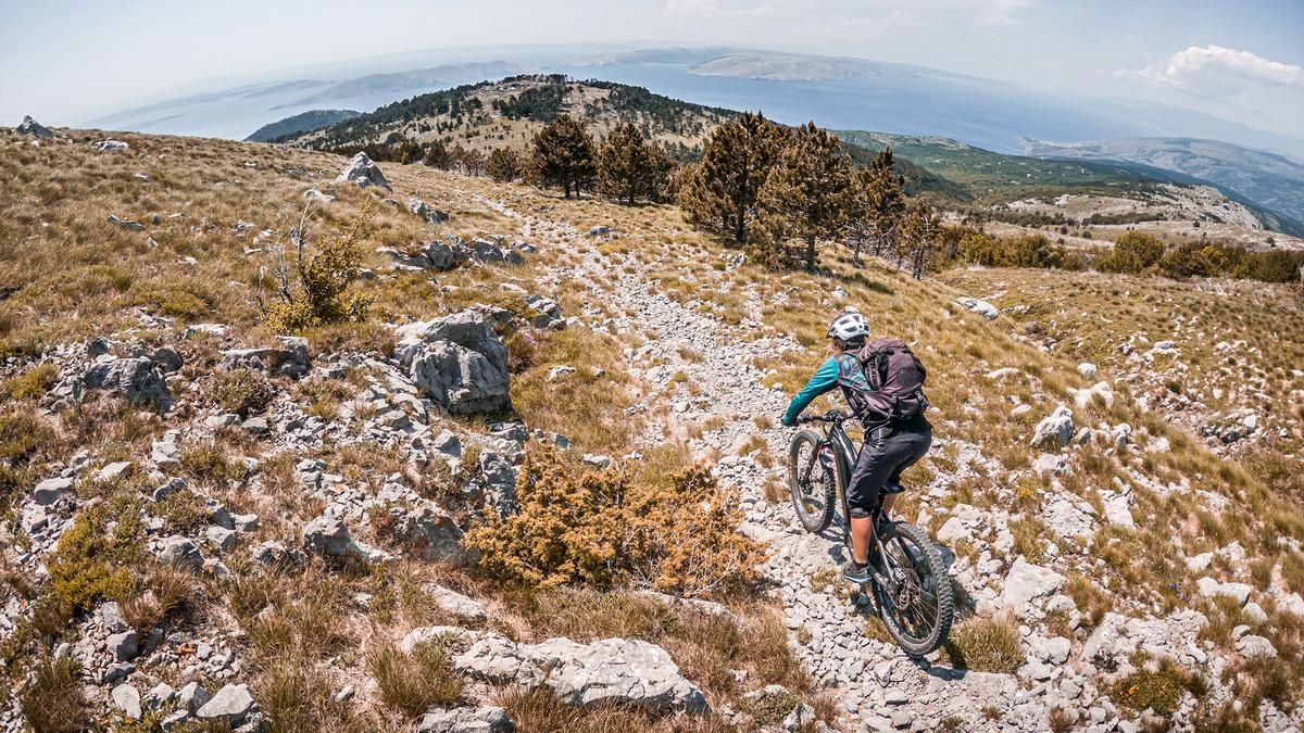
Before starting the tour, it is important to remember to take enough water with you and to pack spare batteries for e-bikes. The uphill of around 35 kilometers to the summit makes the tour challenging. The starting point of the tour is Senj. From here, the route rides alternately over asphalt and gravel, past Forte Nehaj, deeper and deeper into the national park. In good weather, there are impressive views of the islands, especially the island of Krk.
Finally, you reach the highway at Oltari, a small village. From here, the route is flat, initially on asphalt and later on gravel, until you reach the Planinarski dom Zavižan inn. It should be noted that bikers must also buy a ticket here, as this is compulsory in the Velebit National Park and the revenue is used for maintenance. From the inn, you can reach the saddle below the summit of Vučjak and Velika kosa. The last few meters to the summit should be covered on foot, as biking is not advisable here. Once you reach 1622 m above sea level, there are breathtaking views of the depths when visibility is good and there is no fog on the slope.
The trail descent starts at the bike depot and heads north, with different levels of difficulty between S1, S2 and occasionally S3. Finally, you return to the small village of Oltari, where you continue briefly on the ascent track in up and down style and take a few trail shortcuts. The route winds its way further north, crossing the entire northern Velebit National Park area and overcoming intermediate climbs, with the last major one in the Rončevic Dolac area.
Afterwards, a mule track leads directly above Fort Nehaj back to civilization. Overall, this is an extremely long and varied circular tour with different trail classes and different vegetation areas. The tour can also be split into two parts by either riding only the upper or lower part or being shuttled to the Oltari village junction. For those who want to complete the tour in one day, a long and impressive route awaits.
Note: Especially in the summer months, hillside fog can often appear in the summit area and thunderstorms must also be expected in the rear area, as the mountain ridges by the sea are the first major weather blockages. Heavy vegetation is to be expected in the lower area during the summer months, although this can only be recommended to a limited extent due to the high temperatures in July and August.
Map & GPX-Track
The map is only available to Ride subscribers.
The Ride-Subscription is available at ride-mtb.com/abo
.
Details of the tour
72 km
2000 m
2000 m
10 above sea level
1576 above sea level
1 day
Senj
Senj
3193
well suited
More information
More tours nearby


User comments (0)

About the author: Martin Depauli
Note: This content has been automatically translated from German. Please report any incorrect translations.