

Wildstrubel

Description
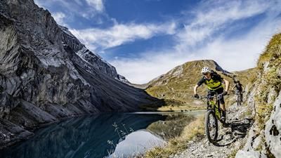
From Lenk, you initially roll along the plain of the Simme and are amazed by the Wildstrubel, which forms the dominant end of the valley from here. From this perspective, it seems impossible that the mountain should be doable by mountain bike. The ascent begins at Zelg on a steep alpine road to the Rezliberg, and from here it's all about shouldering your bike and hiking: Shoulder your bike and hike. There are now 1800 meters of altitude to overcome. You pass the Fluesee lake with its small hut. This is the last opportunity to fill up with water. You then climb further up, soon the view of the Plainemorte glacier opens up and finally you have to hike up a seemingly endless scree slope. The route is a sporting achievement even without a bike on your shoulders. The summit makes up for the exertions: the high alpine panorama in all directions is stunning, almost making you feel like a foreign body on a mountain bike. The descent on the ascent route shows that this is not the case. The trail is easy to ride for good riders, the gravel provides good grip and the hairpin bends are almost all easy to master. Later you pass the Flueseeli again, and from here the trail becomes more challenging. The terrain is steep, the trail is interspersed with roots and ledges in places, but for good mountain bikers it is rideable almost all the way. When you finally ride back down to Lenk on the valley floor and look up to the Wildstrubel once again, you know that there is a route for mountain bikers up there. And what a route it is!
Map & GPX-Track
The map is only available to Ride subscribers.
The Ride-Subscription is available at ride-mtb.com/abo
.
Details of the tour
26 km
2175 m
2175 m
1065 above sea level
3230 above sea level
1 day
Lenk im Simmental
Lenk im Simmental
1492
not suitable
Video
More tours nearby



User comments (5)

About the author: Thomas Giger
Note: This content has been automatically translated from German. Please report any incorrect translations.
but it has to be done
Tour done on 16.08.2022, really very hard until dobe bisch, descent overall very slippery due to the dryness, in the upper part very good rideable, in the lower part from the Flueseeli very exposed and with the fatigue I ride a little less, cool gsi, a little longer
I did the tour yesterday and today. In other words: I bivouacked below the summit, where two small wind shelters were made.
Apart from the fact that you need to be in really good shape or have an iron will to get to the top, the path down from Fluesee is just garbage. I consider myself a good biker with a lot of experience, but this route was about 15% rideable for me. Especially as I'm hanging on for dear life and a mistake would also be my last.
Top view, top summit luck, top part good... once was enough ;)
I did this yesterday, but from Cry d err near Crans, so there's less to carry!
The most impressive part was riding my bike over the Plaine Morte. The trail below the Flueseelis was too difficult for me. I generally prefer to ride on somewhat firmer terrain than on these scree slopes.
Do you have the exact route from cry derr to wildstrubel.greetings geo