

Aiguille de la Grand Sassière
Description
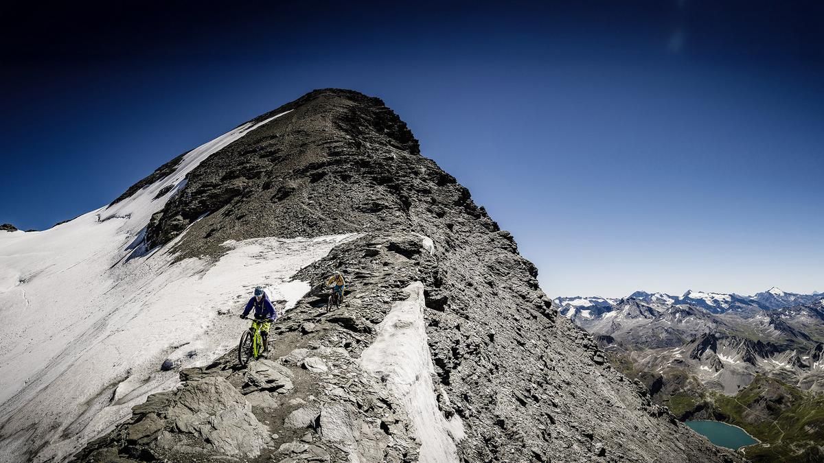
We set off from the parking lot at the small reservoir above Le Villaret on the way from Bourg-St-Maurice to Val d'Isère. You can't even think about riding, the bike is on your shoulders from the very first few meters. But you can't go wrong - there is only one way up to the summit. This first leads through meadows, then follows the ridge all the way to the summit. You need to be sure-footed in places, but the route can easily be hiked in good mountain bike shoes. On the ascent, you might think you can't ride down here. However, it is advisable to lug your bike up to the summit - because you will be proven wrong. The descent follows the same route as the ascent and is rideable almost all the way. Even the summit slope is largely doable for good riders without a fear of heights.
The tour itself belongs in the realm of superlatives. There are few routes where the bike has to be dragged up so far and so steeply. There are few peaks where the views are as stunning as here - Mont Blanc, Grand Combin, Monte Rosa, Matterhorn and Grand Paradiso stand in a row. And hardly any descent is more breathtaking than this path wedged between a glacier and a vertical rock face. In a nutshell: a stunning experience for good skiing technicians with high alpine experience.
Map & GPX-Track
The map is only available to Ride subscribers.
The Ride-Subscription is available at ride-mtb.com/abo
.
Details of the tour
12 km
1400 m
1400 m
1 day
Le Villaret
Le Villaret
1631
not suitable
Video
More tours nearby



User comments (3)

About the author: Thomas Giger
Note: This content has been automatically translated from German. Please report any incorrect translations.
I've already been on the "Gobba di Rollin 3899 m" next to the Klein Matterhorn in Europe...
But there are no trails there, just glaciers.
I rode the tour today. I can only agree with Thomas Giger's tour description. I also thought during the 2nd part of the ascent that at least 50% of the bike would have to be carried down again. But it's definitely worth carrying the bike up to the summit. And lo and behold, in the end about 90% was rideable. (Assuming you have very good biking technique). Towards the end there is even some real flow. What a great descent.
Definitely an epic experience.