

Haute Voltage Trail
Description
Leave Bourg-Saint-Maurice in an easterly direction via main and secondary roads as far as Séez. Here you stay on the main road D1090 and start the climb towards Petit Saint-Bernard. In Villard-Dessous, turn off onto Rue de Pierre Blanches and pedal on to Saint-Germain and Mont Villaret, where you turn right towards Plan de Mont. Here the surface changes to gravel, but the gradient remains pleasant until you reach the highest point of the tour at almost 1700 meters above sea level. Here you leave the ascent on the right and turn onto the forest path.
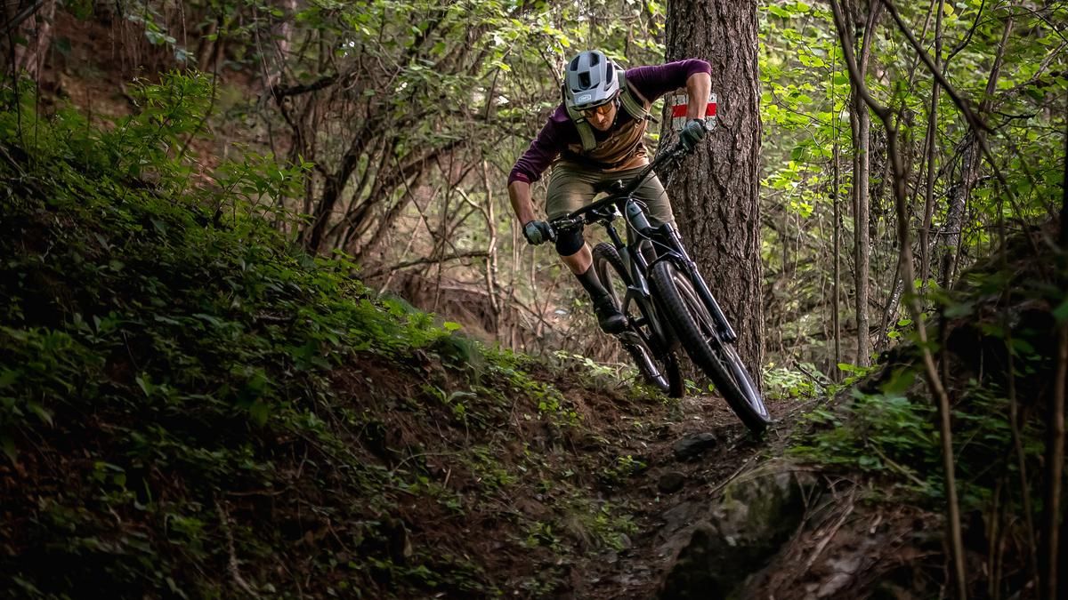
After a few hundred meters downhill on the forest path, the challenging part now begins. The Haute Voltage Trail is embedded in a steep mountain flank and will delight good bikers with its many hairpin bends and some root passages. Even in dry conditions, the narrow path is a real challenge in wet conditions. The blind corners are also not to be underestimated in this steeply sloping terrain. After just under 400 Elevation loss meters, the trail opens up a little and rides relatively smoothly along the slope for another hundred Elevation loss meters - a good change of pace before you turn left and another series of hairpin bends awaits. The tour does not end at the bottom of the valley. The ascent to Les Échines Dessous measures a good 200 meters in altitude, where the final descent to Bourg-Saint-Maurice begins opposite the church. In contrast to the Haute Voltage Trail, the trail sections to Bourg mostly ride along pastures, repeatedly cross the mountain road and pass through the village of Les Maisonettes. They are much easier and smoother to ride but offer technically interesting passages from time to time. However, it is not possible to let your focus slip. Compared to the previous trail sections, the last section is much rougher and more challenging. The trail ends right on the outskirts of Bourg
.Map & GPX-Track
The map is only available to Ride subscribers.
The Ride-Subscription is available at ride-mtb.com/abo
.
Details of the tour
22 km
1100 m
1100 m
808 above sea level
1698 above sea level
1 day
Bourg-Saint-Maurice
Bourg-Saint-Maurice
2596
well suited
More information
More tours nearby



User comments (1)

About the author: Balz Weber
Note: This content has been automatically translated from German. Please report any incorrect translations.
As described: steep and with many switchbacks. The route can be combined with a great tour of Lac Esola by ascending directly from the Pont de Bonneval des Bains toward Les Echines dessus.