

Langmartskopf Trailtour

Description
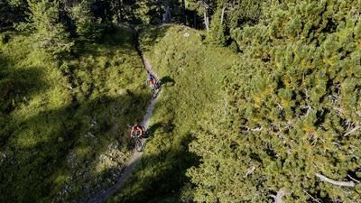
Start at Gernsbach railroad station, where the Murg Valley Railway takes you with suburban trains, express trains and even the Rad-Express on Sundays. There are also plenty of parking spaces available. The route zigzags a little along cycle paths and side roads to the Scheuern district. This is where the first steep ramp begins on the so-called Old Wine Route, a trade route presumably used since Roman times, when there were no roads in the impassable Murg Valley. Shortly after the Hardberghütte, the route flattens out and you pass orchards before reaching the cemetery above the village of Lautenbach. The view takes you over to the Lautenfelsen rocks, which you will reach in around half an hour. Before that, the trail leads down to Lautenbach and then steeply uphill again, then flatter to the aforementioned rock. It's worth a short walk up here. From here, it's another 300 meters up to the highest point on the edge of the moorland plateau of the Langmartskopf. This is the start of the first flat trail to the Langmartskopfhütte, which is a good place to take a break.
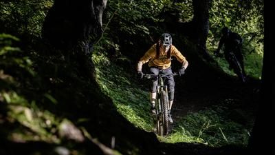
Then the actual long descent back into the Murg Valley begins: in the first, almost four-kilometre-long section, you have to be careful to take the right (right-hand) fork after the end of the somewhat steeper part: After that, the route is flat but never boring to the highlight: the mountain and valley trail above Reichental. The name says it all, and there is a little bit of a rollercoaster feeling. At the end of this section, there is a transfer section on gravel and two small climbs before the second downhill section begins: the Jägerpfad and the trail sections after it flow for miles until you reach the Murgtal road in Obertsrot.
The view falls on Eberstein Castle opposite, which has been towering over the valley with its vineyards since at least the 13th century. The last ascent of the tour rides up there, and if you like, you can stop off at the Platenengarten. Above the parking lot, the last trail descent begins with its hairpin bends down to Gernsbach. You roll into the old town with its numerous cafés and restaurants on tarmac. From here, it is only a short distance back to the train station/car park.
Note: The tour is located in Baden-Württemberg with the legal requirement of a two-meter rule. This tour contains elements that do not comply with this regulation. Rather, it reflects routes that are ridden by local mountain bikers. Compliance with the regulations is the responsibility of each individual mountain biker.
Map & GPX-Track
The map is only available to Ride subscribers.
The Ride-Subscription is available at ride-mtb.com/abo
.
Details of the tour
27 km
995 m
995 m
162 above sea level
917 above sea level
1 day
Gernsbach
Gernsbach
2559
well suited
More tours nearby




User comments (1)
Note: This content has been automatically translated from German. Please report any incorrect translations.
A real dream route in the northern Black Forest! Be sure to try it out!