

Ettlinger Trail-Kombi

Description
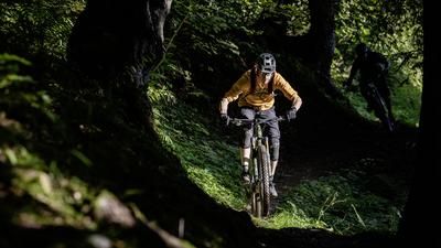
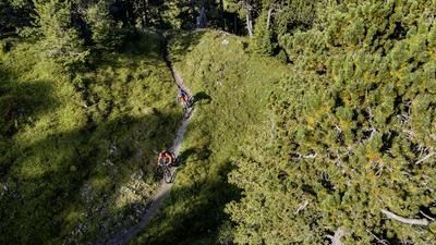
This tour is based in Ettlingen, south of Karlsruhe. Numerous bike trails have developed in the wooded area to the north-east of the town, including the well-known and official electricity pylon downhill. Before you tackle this, there is the Judas Trail. You reach it via a forest road, which requires you to climb a little over 300 meters. The trail is a solid S3 trail with a few tricky sections that occasionally rise into the S4 range in wet conditions. The trail was built by mountain bikers who obviously have a flair for challenging descents.
Departure number two is the well-known power pole downhill, which you reach after another gravel road ascent and a trail traverse. The trail has a bike park feel with banked turns and jumps. Depending on the condition and wear and tear, it can be quite rough. In serpentine mode, it winds its way down the forest aisle under the power line to the edge of the forest not far from the Hedwigshof, where you can refresh yourself with chilled drinks.
Departure number three leads along the official trail called "From Badger Till Dawn". It is again reached via a gravel road ascent. The start of the trail is well marked. Unlike the power pole downhill, this no longer has the character of a bike park, but is instead a great, varied and relatively long forest trail. It ends at the edge of the forest, from where you roll back to Ettlingen on a cycle path.
In this section of forest north-east of Ettlingen, there are other trails that could be added to the tour. They are listed on the Ride Trail Map.
Note: The tour is located in Baden-Württemberg with the legal requirement of a two-meter rule. This tour contains elements that do not comply with this regulation. Rather, it reflects routes that are ridden by local mountain bikers. Compliance with the regulations is the responsibility of each individual mountain biker.
Map & GPX-Track
The map is only available to Ride subscribers.
The Ride-Subscription is available at ride-mtb.com/abo
.
Details of the tour
19 km
600 m
600 m
155 above sea level
345 above sea level
Ettlingen
Ettlingen
3244
well suited
More information
More tours nearby




User comments (0)

About the author: Thomas Giger
Note: This content has been automatically translated from German. Please report any incorrect translations.