

Lettlkaser Hütte

Description
The starting point of the tour is the small hamlet of Rosental. From here, you follow the so-called panoramic route along an official cycle path to Wiesersberg and then steadily uphill through the hamlets of Mitterbrand and Ullach. In Mitterbrand, Ullach a gravel road begins, which you can pedal a few more meters in altitude and then finally carry your bike to the Lettlkaser hut with a view of the Saalfelden basin. The highest point is reached at just under 1450 meters above sea level and a refreshment stop is possible if the hut is open. This refreshment is needed for the challenging downhill that follows.
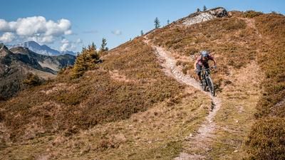
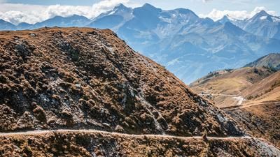
Starting with a small stretcher passage, the ascent route leads downhill, difficulty here is S2 to S4. Then it goes along the traverse with good views. The trail is still somewhat selective for a few meters and then becomes easier and rides towards Mitterbrand, Ullach. Then you branch off in a straight line and follow a trail of difficulty S2 to S3 with a few hairpin bends and some flow sections in the lower part back to the starting point. Once you arrive in Ullach, there is a small trail cut-off along the Birnbach stream before you reach the starting point in Rosental.The tour should not be started in the summer months, as the alpine pasture is sometimes quite busy at weekends. Ideally in fall and spring, this tour offers an effective and panoramic all-mountain tour due to the low altitude. With regard to e-bikes, it should be noted that the tour is relatively easy to do, but the push section must be used with a push function, or the last few meters to the hut must be climbed on foot.
Note: The route is located on Austrian territory and leads over routes that are not approved for mountain bikers. Riding this route on a mountain bike is the responsibility of each individual, in full awareness of the legal situation.
Map & GPX-Track
The map is only available to Ride subscribers.
The Ride-Subscription is available at ride-mtb.com/abo
.
Details of the tour
15 km
675 m
675 m
736 above sea level
1439 above sea level
1 day
Leogang
Leogang
3147
limited
More information
More tours nearby

User comments (0)

About the author: Martin Depauli
Note: This content has been automatically translated from German. Please report any incorrect translations.