

Mont Joly
Description
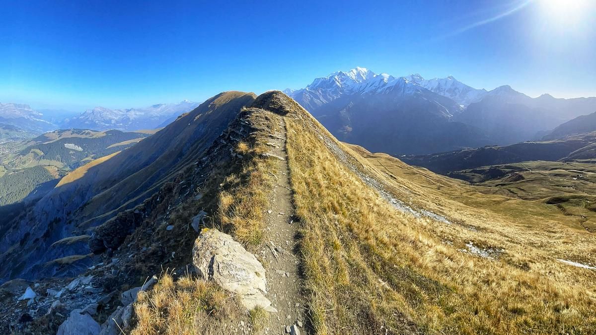
Those who are out and about in July and August benefit from the mountain railroads in Les Contamines, which run almost all the way up to the Col du Joly. If you are out and about during this time, you save yourself the meters in altitude, but also share the route with hikers. The route is more attractive in the fall. Then the air is clear and the trails are deserted. However, you need to manage the 800 meters in altitude, some of which are quite steep, under your own steam. After Mont Joly, however, muscle power is required anyway. You climb up a small road to the summit of the Tête du Véléray. If you have good riding skills and are not afraid of heights, climb up to the ridge beforehand and follow it to the Tête du Véléray. Beware, the path here follows directly along the rock face, which drops steeply down towards Megève. After the Tête de Véléray, the ridge is wider and you have to carry your bike a few meters up to the Tête de la Combaz. If you want, you can then tackle the summit of Mont Joly on foot, although this has no more to offer in terms of trails and views than the previous sections. The Tête de la Combaz is the starting point of the serpentine descent back to the valley floor. The first part is crisp because the path is cut deep into the meadow terrain. After the alpine hut, however, the trail becomes fun and flowy and rides this way to La Tapée. Now, due to the lack of singletrail options, a stretch of gravel and asphalt road is the order of the day until a singletrail branches off to the right further down. This forms the rooty final section of the tour.
Map & GPX-Track
The map is only available to Ride subscribers.
The Ride-Subscription is available at ride-mtb.com/abo
.
Details of the tour
22 km
1380 m
1380 m
1171 above sea level
2431 above sea level
1 day
Les Contamines-Montjoie
Les Contamines-Montjoie
2607
limited
More information
More tours nearby
User comments (1)

About the author: Thomas Giger
Note: This content has been automatically translated from German. Please report any incorrect translations.
I rode part of the tour on my Mont Blanc circumnavigation on 18.07.2024. As I came from Beaufort, I started directly on Mont Joly. The next ascent is then easy to ride until I have already left the track again in the direction of Aiguille Croche. Up to the end of the track, the road is easy to ride (except for a few ultra-steep ramps), from there you have to shoulder the bike up to the antenna. The view up there and along the entire ridge path is phenomenal. At the Tête du Véleray, you return to the original track. However, most of the ridge path is very exposed and a fall would have fatal consequences, so I descended more than was really necessary. All in all, I rode about 80% of the trail, the rest was too blocked or too exposed or one of the short counter-ramps. The downhill (meadow trail) itself is washed out almost 1m deep at the beginning, but still easy to ride and became more and more fun the longer I rode it, until 3 guard dogs surrounded me and the shepherd made no effort to call them back for minutes. It was only when Christian from mountainbikereisen.ch happened to join us that the shepherd moved on with his sheep and then at some point the dogs also left. It seemed that the trail had been turned into a mountain road further down, and so the trail ended earlier than on the map. There was another short trail quite far down, but it shared the path with a stream and was therefore very slippery. All in all, apart from the livestock guarding dogs, it was a cool ride, but it's not exactly suitable for everyone because it's very exposed.
I ride a Scott Genius Ultimate and am usually in the head group uphill; downhill I'm always the last one by a long way.