

Sonntagshorn

Description
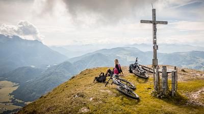
The starting point of the tour is the crossing into Heutal (approx. 1000 meters above sea level) at the hiking parking lot. From here, the route follows a relaxed forest road through the forest to the Hochalm. At the Hochalm itself, you are above the tree line and can already catch the first panoramic views. From the Hochalm, the route becomes steeper and steeper until you reach the saddle below the Perchthöhe. The last few meters are only pedalable for absolute pros, otherwise the bike is pushed here due to the steepness. From the saddle itself, the route then climbs in an up-and-down manner to the Perchthöhe and then zigzags up to the Sonntagshorn at almost 2000 meters above sea level, like a military road in the Dolomites. At the summit, the panorama is magnificent. There are breathtaking views in all directions and striking peaks over the Loferer Steinberge, the Hohe Tauern, the Chiemgau Alps and Lake Chiemsee itself can be admired.
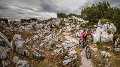
About the descent: In the upper section, the ascent route is also the descent variant. On difficulty levels S1 to S3, it goes down to the Perchthöhe. However, the trail should not be wet, as otherwise the difficulty can rise to over S4, but it is easily doable in dry conditions. From the Perchthöhe, no relaxation is to be expected in terms of riding technique. The same level of difficulty takes you down to the Hochalm and steadily down to the Angerertal. From Angerertal, you can then enjoy a relaxed ride to the main road and from here back to the starting point at the parking lot.
Note: The route is located on Austrian territory and leads over routes that are not approved for mountain bikers. Riding this route on a mountain bike is the responsibility of each individual, in full awareness of the legal situation.
Map & GPX-Track
The map is only available to Ride subscribers.
The Ride-Subscription is available at ride-mtb.com/abo
.
Details of the tour
14 km
890 m
890 m
977 above sea level
1887 above sea level
1 day
Heutal
Heutal
2752
not suitable
More information
More tours nearby



User comments (0)

About the author: Martin Depauli
Note: This content has been automatically translated from German. Please report any incorrect translations.