

Summit - Downtown

Description
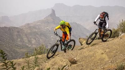
The starting point of the tour is Cruz de Tejeda in the summit region of Gran Canaria. The route begins with a short ascent on asphalt before the signposted hiking trail branches off to the right and the singletrail descent through the green north side of the island begins. The first section is a flowing ride through the typical pine forest of the summit region. With every meter of descent, the vegetation becomes greener, denser, almost primeval. It is the sprouting contrast to the dry north side. The paths here are also earthier and less rocky. In other words: more flowy. You pass through the village of Lanzarote and wind seemingly endlessly through the deciduous forests and large fern bushes down into the Barranco del Quarquillo Madrelagua. The long jungle descent ends in El Rincón, where the second part of the route begins.
This involves a climb, initially on asphalt, then on gravel and finally steeply up to the Camino de Osorio ridge. This adds up to 100 meters in altitude before the route rides downhill again. A super smooth trail now winds its way downhill, agile, fast and varied. You whizz down to the road, complete a short section on asphalt, including a climb, until you reach the military exclusion zone of the "El Picacho" naval surveillance area and start the descent again. Here you share the terrain with motocrossers who have created perfectly shaped trails. The region between El Picacho and the town of Santidad is a first-class playground. There are countless trail options here. In Santidad, after the trail passage in the stream bed, the fun is over for now, followed by an intermediate phase on asphalt to Los Giles. The village lies high above the city center of Las Palmas and is surrounded by numerous single trails. You ride smoothly and agilely through the plateau and then roll down to the sea on an old road on the final section and almost directly into one of the city centers of Las Palmas.
Note: Do not tackle the tour in wet conditions (especially directly after rainfall). The trails are then very slippery and very sticky, especially after El Picacho, making them almost impossible to ride.
Map & GPX-Track
The map is only available to Ride subscribers.
The Ride-Subscription is available at ride-mtb.com/abo
.
Details of the tour
40 km
470 m
1980 m
7 above sea level
1614 above sea level
1 day
Cruz de Tejeda
Las Palmas de Gran Canaria
2678
well suited
More information
Several options in the villages along the route
More tours nearby



User comments (0)

About the author: Thomas Giger
Note: This content has been automatically translated from German. Please report any incorrect translations.