

Wolfacher Trail Tour

Description
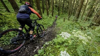
From the town center in Wolfach, you initially roll along the River Kinzig to the football pitch and climb up a gravel road to the Helblingsweg. This rides slightly downhill along the slope, a first-class flow guarantee. The Helblingsweg is, so to speak, the way to start the day. You reach a gravel road and climb up past the Hasenkopf almost as far as the Burgeck. Here you turn left into the Grossvater-Wegle. This Grossvater is a twisty type, with a few rough edges in between. The trail leads down to Oberwolfbach and thus to the starting point of the ascent to the wind turbine at Erlets. Up to Michelshof on asphalt, then on gravel, you climb the 500-metre ascent to the windmill. The next descent is on the agenda here: a winding, sometimes quite steep but very fun and varied path (signposted as a mountain bike route) leads downhill almost to the first houses of Oberwolfbach.
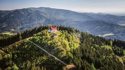
And you switch back to ascent mode, this time with the destination Spitzfelsen. The transfer section also includes a descent, which means you "lose" around 100 meters in altitude before taking the trails to Spitzfelsen. Shortly before the summit, however, you branch off to the left onto the Otto Bührer Trail, which, after a combination of bends in the uppermost valley, actually rides straight ahead to the Wolfbach clinic district. At the edge of the forest, keep left and climb up one last time, this time to Wolfsberg, where the Wolfsberg Trail provides a first-class finish to this trail-friendly route.
Note: The tour is located in Baden-Württemberg with the legal requirement of a two-meter rule. This tour contains elements that do not comply with this regulation. Rather, it reflects routes that are ridden by local mountain bikers. Compliance with the regulations is the responsibility of each individual mountain biker.
Map & GPX-Track
The map is only available to Ride subscribers.
The Ride-Subscription is available at ride-mtb.com/abo
.
Details of the tour
27 km
1230 m
1230 m
263 above sea level
691 above sea level
1 day
Wolfach
Wolfach
2360
well suited
More information
More tours nearby

User comments (0)

About the author: Thomas Giger
Note: This content has been automatically translated from German. Please report any incorrect translations.