

Ahorn

Description
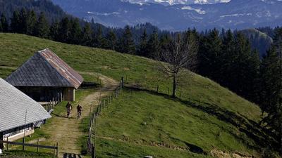
In Huttwil, the route leads to the eastern edge of the village and then via Willimatt to Hitzenberg and finally along a small road up to Ahorn with its magnificently situated restaurant. The ascent from the starting point to the Ahorn is 500 meters in altitude, and that's the entire ascent of the tour. The return journey to Huttwil follows the ridge to the west. From Ahorn, initially follow the rooty single trail to Fritzeflue and turn right here. The descent from here to Huttwil is pure Alpine foothills idyll as you mostly follow country and gravel roads through the wonderfully hilly area between Eriswil and Wyssachen.
Map & GPX-Track
The map is only available to Ride subscribers.
The Ride-Subscription is available at ride-mtb.com/abo
.
Details of the tour
22 km
645 m
645 m
636 above sea level
1107 above sea level
1 day
Huttwil
Huttwil
1474
well suited
More tours nearby



User comments (0)

About the author: Thomas Giger
Note: This content has been automatically translated from German. Please report any incorrect translations.