

Blueme

Description
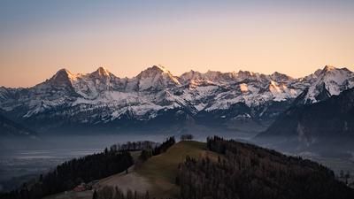
From Thun railroad station, follow the marked mountain bike route (Route 2) to Steffisburg and up the mountain road to Buchen. Turn left here and follow the Veloland route to Multenegg. Immediately after the group of houses, a forest path branches off to the left and rides up to the summit of Blueme with its viewing tower. The 840-metre ascent from Thun is well worth the effort: the view of Lake Thun and the Bernese Oberland beyond is fantastic. But the descent is also worth the climb. This rides along the ridge path to the edge of the forest near Heiligenschwendi, then downhill along the Veloland route for a while and then to the right on a singletrail high above the Riderbach stream to Oberhofen. Through the residential area and along the main road, you then reach the center of Thun again.
Map & GPX-Track
The map is only available to Ride subscribers.
The Ride-Subscription is available at ride-mtb.com/abo
.
Details of the tour
36 km
1230 m
1230 m
556 above sea level
1391 above sea level
1 day
Thun
Thun
1036
well suited
More information
More tours nearby




User comments (7)

About the author: Thomas Giger
Note: This content has been automatically translated from German. Please report any incorrect translations.
We did a modified version of the tour. The ascent was via Goldiwil (the entire tour was 6 km shorter). The first short trail (700 m) is a fun, steep root trail with high steps, possibly too tough for the inexperienced, but it was great fun for us. Unfortunately only a short fun ride. Then it's downhill on tar and then up another 300 meters to the Blueme viewing platform. The last climb is very steep and really gets the pulse racing. Then it's downhill on a beautiful trail dotted with small steps. The route then alternates between beautiful single trails and tarmac roads downhill. We then took a different route at KM 28. It was a bit overgrown, but still rideable and actually quite nice. We also came down another trail near Underi Allmend. Partly challenging (with stairs), but beautiful trails between the gorge and the stream bed. After the tour, you can cool off with a cold beer at the lake. I can recommend this tour, although unfortunately there is also a lot of road.
A worthwhile tour. The Bluemewald trail is still closed from the halfway point with a sign about shooting practice, but the overgrown trail didn't look very inviting, so we didn't risk it. Similarly, the entrance to the detour trail after the Blueme is barely recognizable from the road (as it is overgrown), but it is rideable. Be sure to stop at the buvette on Lake Hünibach on the way home. It's worth it for a swim, drink/eat or simply to enjoy the view. We would ride the tour again.
Great tour. We took the Posti to Heiligenschwendi. Despite Whitsun, there were very few hikers on the trails. Most of the trails from the Blueme viewpoint are almost impossible to find without a GPS. Unfortunately, this was partly due to dismantled signposts.
But with GPS and a bit of searching, almost no meters in altitude have to be wasted on forest or even tarred roads.
I followed the GPS one hundred percent and can understand the statement about too much tar. In addition, this junction on the right is extremely overgrown and hardly rideable. And down in the residential area, many steps have been built and bicycles are prohibited. My overall conclusion: nothing special, but definitely nice. It has a bit of everything...
As Cyrillic writes, with GPS a pretty good ride, but without GPS very hard to find!
Comfortable ascent and great views. The descent is great singletrail at the beginning, then only asphalt - you would have to improvise... (which didn't quite work for us ... :)
Not quite true. I know the trail pretty well, just don't miss the turn-off to the right on the intermediate section on the tarred road. GPS is certainly helpful :-) There are still one or two good sections to come :-)