

Cima Rebuffao
Description
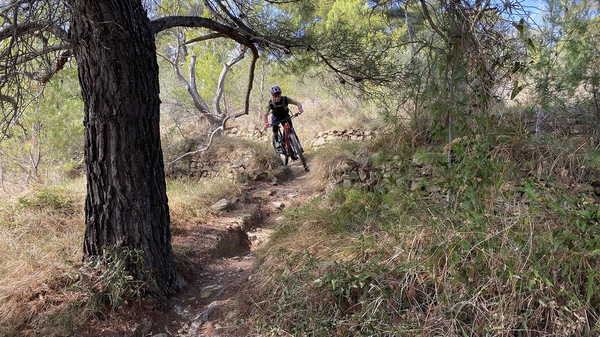
The tour starts at the beach of Vallecrosia near Ventimiglia. Take the cycle path along the Nervia river and then ride along the main road to Camporosso and continue along the cycle path until just before Dolceacqua. It is worth taking a coffee break here before turning right onto the SP69. After about eight kilometers, turn right onto a forest road. After a right-hand bend, turn left onto Cima Rebuffao and push your bike up. The first trail section begins at the top, very steep and gravelly, you are at the limits of rideability here. You come to a forest road and ride along it for a while until you continue on a tarred road towards the sea. After about 900 meters, there is a turn-off to the right onto a gravel road. It goes very steeply up to the left through the forest to the start of the Cadillac Trail. The trail is steep, gravelly and sandy, with a few bends, until you pass an old Opel Rekord (Cadillac) and continue down the forest road. You come to a tarred road and ride on towards the sea. At a prohibition sign, the road climbs very steeply to the left. There are prohibition signs everywhere, so it's up to you to decide whether you want to embark on this adventure. However, it is not recommended at the weekend as there are a lot of hunters out and about. Once you reach the top, you have a wonderful view of the sea. The trail soon begins on the right. It first rides along the slope on the left and then drops steeply to the right. The trail descends to Vallecrosia, interspersed with rocks and stones, and you ride back to the sea along the cycle path.
Map & GPX-Track
The map is only available to Ride subscribers.
The Ride-Subscription is available at ride-mtb.com/abo
.
Details of the tour
30 km
835 m
835 m
1 above sea level
570 above sea level
1 day
Vallecrosia
Vallecrosia
2791
well suited
More tours nearby


User comments (1)
Background to Ride MTB
Ride MTB is dedicated to mountain biking. With the maps Ride Trail Maps and Trail Books and the print magazine Ride, it has played a formative role in alpine mountain biking for many years and has shaped it like few other organizations.
In addition to the publishing business, the company is now also active in product management and operating entire mountain bike projects. These include the tourism project Ride Travel and the development of modern and authentic mountain bike offers such as the Bahnentour in Davos Klosters, Engadin St. Moritz, Lenzerheide or Aletsch, as well as the creation of multi-day tours such as the Postauto-Tour or the Hüttentour.
Ride MTB GmbH was founded in 2001 (formerly Swiss Sports Publishing GmbH) and has been owned and managed by Thomas Giger since then.
Publishing and editorial address
Ride MTB GmbH
Falladagasse 11
CH-7212 Seewis
+41 81 413 43 43
info@ride-mtb.com
Subscription management
Advertisements
Administration
Bank details: Graubündner Kantonalbank.
CHF account. IBAN: CH86 0077 4010 2958 8310 1, BIC: GRKBCH2270A
EUR account. IBAN: CH32 0077 4010 2958 8310 3, BIC: GRKBCH2270A
Company identification number (UID): CHE-102.170.292
The brains behind Ride MTB










Note: This content has been automatically translated from German. Please report any incorrect translations.
A nice trail ride? That description is simply wrong. Down from the summit on a steep, eroded trail section. It was manageable at first, then a rapid descent on mostly gravel and asphalt. Push your bike up 350 meters of elevation gain to Monte Belavista; after 60 meters of descent, turn left because the ridge trail ends after 100 meters. So continue on the road; for the final climb to Santa Croce, there’s a gap in the fence—otherwise, you can’t reach the concrete road climb. This climb is steep but rideable. At the trail junction, there are “No Entry” signs, though it’s unclear whether they refer to the area off the trail—in any case, ride the trail. The first part is great up to the settlement; the rest is a neglected, eroded former path that’s barely rideable. Overall verdict: Not worth it as a trail tour; the descent from Croce is the only nice part.