

Hornisgrinde Trail-Tour
Description
The starting point of the tour is the pretty Black Forest village of Sasbachwalden near Achern. First up is the 700-metre ascent to Unterstmatt on the Schwarzwald Hochstrasse. This rides along gravel roads with a pleasant gradient. At weekends and on public holidays, it is also possible to make the ascent by bus. This carries a large bicycle trailer on designated rides. From Unterstmatt, roll over to Hundseck, climb a little further up a gravel road and then turn right onto the great S1 trail down into Gressbachtal. This takes you to Aschenplatz and you continue on country roads to Hundsbach.
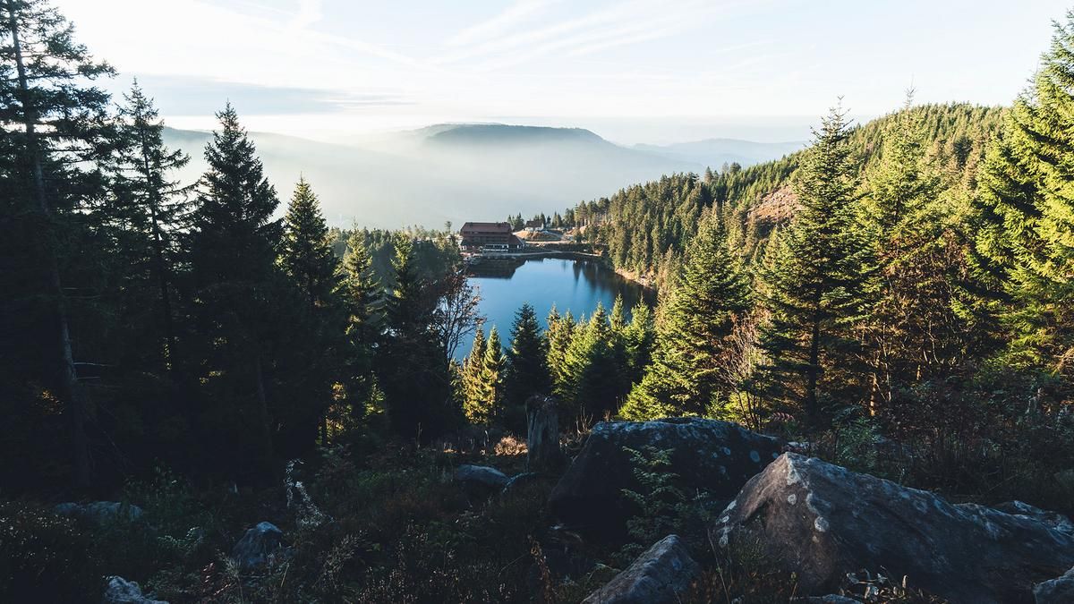
This is the second part of the tour. Here you climb up on gravel roads to the ridge at Diebaukopf. A beautiful S2 path rides along the ridge, and after the Tanzplatz, it turns into a racy descent on the left. Finally, you reach a gravel road and roll along it around Seibelsecke on the Schwarzwald Hochstrasse. This marks the start of the third part of the tour. The route takes you up to the Mummelsee lake and along a road up to the summit of the Hornisgrinde. The high plateau with the transmitter antenna and the wind turbine offers a first-class view of the Rhine Valley, the Vorgesen and, above all, the entire northern Black Forest. The downhill trail starts at the edge of the forest not far from the summit. The trail initially shows its crisp side. The descent is rough and rocky in S3 style down to the Schwarzwald Hochstrasse. The Alpirsbacher Schwarzwald Trail, a trail built for mountain bikers, begins at the hikers' parking lot. There are huge jumps at the start, but you can roll around them all. Then it's a bike park-style descent to Breitenbrunnen, where the character of the trail changes. A beautiful enduro trail in the S2 area with individual, short trail climbs leads past the Schlossberg to Hörchenberg. For the final section back to Sasbachschwalden, you have to make do with an asphalted cycle path; the nearby path through Gaishölle is marked with a no-biking sign. Conclusion back in Sasbachwalden: One of the top tours in the northern Black Forest, which impresses with its many facets and great trails.
Note: The tour for a short stretch through the Black Forest National Park with a general ban on biking off designated routes.
Note: The tour is located in Baden-Württemberg with the legal requirement of a two-meter rule. This tour contains elements that do not comply with this regulation. Rather, it reflects routes that are ridden by local mountain bikers. Compliance with the regulations is the responsibility of each individual mountain biker.
Map & GPX-Track
The map is only available to Ride subscribers.
The Ride-Subscription is available at ride-mtb.com/abo
.
Details of the tour
46 km
1510 m
1510 m
246 above sea level
1157 above sea level
1 day
Sasbachwalden
Sasbachwalden
2469
well suited
More information
More tours nearby


User comments (4)

About the author: Thomas Giger
Note: This content has been automatically translated from German. Please report any incorrect translations.
Unfortunately, the trails on the climb up to Hornisgrinde are currently blocked by logging operations, so it’s best to head straight to Mummelsee / Hornisgrinde. Otherwise, it’s a great route.
A very beautiful tour with varied trails. If you arrive by public transport, you can also start in Forbach and ascend via Gasthaus Sand and then descend to Achern.
Technically, however, I think the tour deserves three stars. After all, the author himself talks about S3 sections (which aren't that wild either, a bit of bumpy bouldering)...
I know the trail from the Hornisgrinde and the Alpirsbach Trail and can only recommend both! If you don't like "unnecessary" kilometers but rather just like trails, you can ride another trail from the Hornisgrinde instead of the loop in the east. In my opinion, it's a bit more difficult than the other one.
Kesselbachtrail: https://trailguide.net?pos=13,48.61009510411698,8.18017182932664&map=tr…
All three combined make a really great tour that you have to find again in the area. As far as I remember, the trails on the Hornisgrinde say that they are maintained by the local MTB club.
I know the Kesselbach Trail, which in my opinion is at the limit of what is rideable and sensible. I didn't enjoy it because it was simply too rough. In addition, there are many hikers on this trail who hike down from the Hornisgrinde to the Mummelsee. However, the descent via Hundsrücken to Unterstmatt is a good option for extending the route. However, I can recommend the two trails on the original route, which are really nice to ride.