

Tête de Balme (Chamonix)

Description
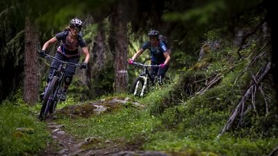
If you start this tour in Chamonix, first take the train towards Martigny and ride it to Vallorcine. Then switch to the gondola lift and ride up to Posettes. From here you continue under your own steam. A gravel road leads up to the Col des Posettes and on to the Col de Balme. Now it's time for singletrack, although the first section is prohibited for bikes in July and August. The path is clear, but hikers can be spotted early on, and in high season it is best to push a few meters up to a plateau just below the chairlift mountain station. From here, you can ride freely again (after all, you are now on Swiss soil). A super trail now leads down to Alp Catogne and then down to the village of Cretton in an even more flowing manner. The final section to the valley floor is a little rough and interspersed with hairpin bends, but a good change from the previous flow orgy. Once at the bottom of the valley, follow the road and, after the national border, a bike route back to the valley station in Vallorcine.
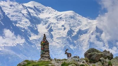
Now it's time for the second part of the tour, the return trip to Chamonix. To do this, get back on the Posettes gondola, climb back up to the Col des Posettes, but then turn right onto the single trail, which climbs gently up to a hill. The panorama of the Mont Blanc group from here is stunning! And the trail is unparalleled fun, with only a few water barriers slowing down the flow at the start. The descent to Le Tour is challenging, rough, rocky and winding, but great fun for experienced mountain bikers. You reach Le Tour in trail mode and then tackle the long singletrail section back to Chamonix. Cross-country mode is now the order of the day. You follow the left flank of the valley up and down, pass Argentière, fight your way up a bit and finally reach the center of Chamonix in this style.
Map & GPX-Track
The map is only available to Ride subscribers.
The Ride-Subscription is available at ride-mtb.com/abo
.
Details of the tour
33 km
745 m
2300 m
1038 above sea level
2211 above sea level
1 day
Chamonix
Chamonix
2089
well suited
More information
More tours nearby




User comments (0)

About the author: Thomas Giger
Note: This content has been automatically translated from German. Please report any incorrect translations.