

Wildenkarkogel – Mardeckkopf

Description
The tour starts between Viehhofen and Saalbach near the hamlet of Igelsberg. From here, the official bike route leads uphill on asphalt and later on gravel past Rachkuchl and under the Schönleitenbahn. Finally, you change from asphalt to gravel and reach the Schönleitenhütte. Now it's time to grit your teeth once again, as the trail climbs steeply up to the Wildkarkogel reservoir and the summit cross. The view here is breathtaking. From the Loferer Steinberge mountains, across the Saalfelden valley basin on the Steinernes Meer, as well as the Hohe Tauern to the south, you can see everything on a clear day.
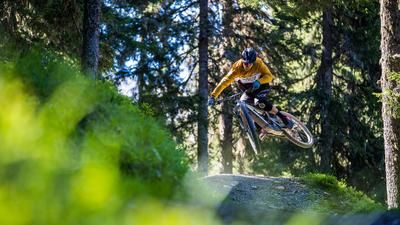
The descent then begins. Before that, you cross the single trail past the Pründelkopf, the so-called Saalachtaler Höhenweg. It should be noted that this is mostly rideable. You then come to the so-called Wurzel-Trail on the BIG-5-Challenge. This is fantastic in the dry, but rather unpleasant in the wet. The route continues in this manner on difficulty levels S1 to S2 and crosses the entire panoramic route below the Wildenkarkogel until you get back to the Schönleitenhütte. The route then briefly descends towards the Poltenalm on gravel and finally takes you down an idyllic single trail with difficulty levels S1 to S2 along the Hochwartgraben before the loop closes again.
Conclusion: A perfect panoramic tour that is particularly suitable in dry weather in the fall. For those who complete the tour during the bike season, the Kohlmaisbahn is a good shuttle service.
Note: The route is located on Austrian territory and leads over routes that are not approved for mountain bikers. Riding this route on a mountain bike is the responsibility of each individual, in full awareness of the legal situation.
Map & GPX-Track
The map is only available to Ride subscribers.
The Ride-Subscription is available at ride-mtb.com/abo
.
Details of the tour
20 km
1005 m
1005 m
931 above sea level
1877 above sea level
1 day
Saalbach-Hinterglemm
Saalbach-Hinterglemm
3120
well suited
More information
More tours nearby




User comments (1)

About the author: Martin Depauli
Note: This content has been automatically translated from German. Please report any incorrect translations.
Very nice tour with a high proportion of trails - everything is very easy to ride... and a wonderful mountain panorama to boot. Top!