

Bergstadl Trail-Runde
Description
Start in Hinterglemm and roll out of the valley through Saalbach and past the Schönleitenbahn. In Jausern, turn left onto the Lohnersbachweg. This is where the long ascent to the Schattberg and on to the western summit begins. The ascent is ten kilometers long in total and can also be easily mastered with the Schattbergbahn.
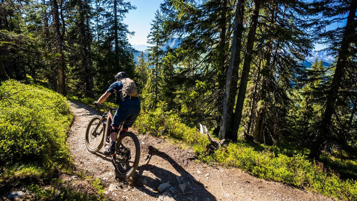
At the western summit, you enter the Hacklberg trail, after a few bends you turn right onto the Bergstadl trail. In the treeless terrain, the trail is quite fast until you reach the first trees, where it gets steeper. There are a few hairpin bends in the middle section, but these can be ridden without having to transfer, as the trail becomes steeper and more rocky. Once you reach the forest, the route takes you over some root carpets and is no less steep. The Bergstadl is the most challenging trail in Saalbach-Hinteglemm. The terrain doesn't get any easier in the lower section either. Roots and steep steps line the trail and by the Bergstadlalm you're pretty exhausted. You return to Hinterglemm via the Buchegg trail.Map & GPX-Track
The map is only available to Ride subscribers.
The Ride-Subscription is available at ride-mtb.com/abo
.
Details of the tour
26 km
1190 m
1190 m
931 above sea level
2076 above sea level
1 day
Hinterglemm
Hinterglemm
2960
well suited
More information
More tours nearby



User comments (2)
Background to Ride MTB
Ride MTB is dedicated to mountain biking. With the maps Ride Trail Maps and Trail Books and the print magazine Ride, it has played a formative role in alpine mountain biking for many years and has shaped it like few other organizations.
In addition to the publishing business, the company is now also active in product management and operating entire mountain bike projects. These include the tourism project Ride Travel and the development of modern and authentic mountain bike offers such as the Bahnentour in Davos Klosters, Engadin St. Moritz, Lenzerheide or Aletsch, as well as the creation of multi-day tours such as the Postauto-Tour or the Hüttentour.
Ride MTB GmbH was founded in 2001 (formerly Swiss Sports Publishing GmbH) and has been owned and managed by Thomas Giger since then.
Publishing and editorial address
Ride MTB GmbH
Falladagasse 11
CH-7212 Seewis
+41 81 413 43 43
info@ride-mtb.com
Subscription management
Advertisements
Administration
Bank details: Graubündner Kantonalbank.
CHF account. IBAN: CH86 0077 4010 2958 8310 1, BIC: GRKBCH2270A
EUR account. IBAN: CH32 0077 4010 2958 8310 3, BIC: GRKBCH2270A
Company identification number (UID): CHE-102.170.292
The brains behind Ride MTB












Note: This content has been automatically translated from German. Please report any incorrect translations.
The description under “Route” is incorrect: This loop does not take you to Leogang or to the Asitzbahn mountain station!
Great ascent with wonderful views of the mountains (signposted as the Schattbergrunde) and the crisp Bergstadl descent make this a tour worth recommending.