

Napf-Cross

Description
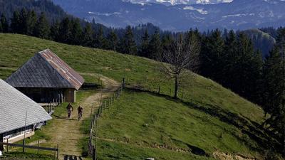
From Wolhusen, initially follow the cycle route along the Kleine Emme upstream, but then turn right before Doppleschwand and head along a country road through the Fontanne-Tobel. At Hapfig, you reach the official mountain bike route (Route 77), which you follow to Stächelegg. The final ascent to Napf is short and steep, but the view from the summit is stunning. On a clear day, you are directly opposite the main Alpine ridge with its countless glacier peaks. The scenery is particularly beautiful in the fall, when the air is clearer than in other seasons. From Napf, you now follow the ridge to Hochänzi, Ober Scheidegg and finally Ahorn on a variety of first-class single trails and sometimes steep alpine roads. The ridge path then forms the basis for the rest of the route and leads over the Fritzeflue and Freudigenegg to Wasen in the Emmental. Conclusion: The long descent from Napf to Emmental is one of the best routes far and wide! To get to Burgdorf, cycle via Sumiswald to Lützelflüh and then follow the left bank of the Emme to the center of Burgdorf.
Map & GPX-Track
The map is only available to Ride subscribers.
The Ride-Subscription is available at ride-mtb.com/abo
.
Details of the tour
56 km
1170 m
1200 m
1 day
Wolhusen
Burgdorf BE
1145
well suited
More information
No bike schools are registered for this region. Registration as a partner takes place here.
More tours nearby




User comments (4)

About the author: Thomas Giger
Note: This content has been automatically translated from German. Please report any incorrect translations.
I did a Napf cross in the opposite direction. I reached Ahorn from Willisau via various country lanes and then mainly on the ridge to Niederenzi and then mostly on single trails up to Napf. The last ascent was difficult, as I mainly had to push or carry the bike. From Napf I took the easy ride down to Wohlhusen. I rode down the path and the road that is described on the Ride Magazine (Napf Cross) as an ascent. This descent is very panoramic. I recorded some of this tour on video (except for the pushing parts) and you can follow this tour on YouTube and possibly ride along on the home trainer.
https://youtu.be/l4UeU75mq3k
The view is wonderful, but the counter-climbs after the Napf are very steep and tough. Very little singletrail and most of the route is on roads.
We turned it into a two-day tour and spent the night on the Napf (50+60km). It was also primarily about riding across Lucerne to Bern :-) The approach was very idyllic from Bern station via VelolandRoute no. 24 to Wohlhausen. Then the GPX trail from ride.ch. Up early the next day, enjoy the trail for yourself and before ~ Hasle b.B. turn into route 84 to Bern - this part of the route is a bit long, but as I said: it's all about the principle :-) You can end it with an Aarenbad. Rather in spring/autumn or possibly during the week - there is always a lot going on on the Napf. Be sure to make a reservation at the Napf.
Do you have the GPX file of your tour? Thank you