

Geissgratflue

Description
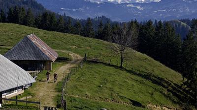
From Langnau, the route follows a minor road to Bärau, then flat along the Gohl stream for a while until the crisp ascent begins. This initially rides along a small road via Grindlen to Schwendi. Now it's time for the gravel paths and single trails, on which you continue to gain height, pass Schynenalp and finally reach a trail near Geissgratflue. This is the highest point of the tour and the descent begins. The route rides past the Rotchnubel to Lüdernalp. Here you keep left, reach the Tällihüttli, later the Fluhüsli, and along the ridge between the two Frittenbachgraben trenches back to Langnau.
Map & GPX-Track
The map is only available to Ride subscribers.
The Ride-Subscription is available at ride-mtb.com/abo
.
Details of the tour
30 km
1110 m
1110 m
672 above sea level
1308 above sea level
1 day
Langnau im Emmental
Langnau im Emmental
1471
limited
More tours nearby




User comments (1)

About the author: Thomas Giger
Note: This content has been automatically translated from German. Please report any incorrect translations.
Wonderful (spring) tour in the Emmental. Not really technically challenging, but beautiful scenery. You feel like you're in a Gotthelf movie.
The first part up to Lüdernalp with lots of singletrails. From Lüdernalp, unfortunately, almost exclusively on forest and gravel paths.