

Cervinia-Rundtour

Description
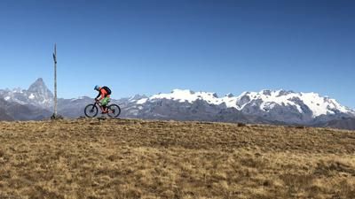
The route starts in Cervinia, where you initially follow the main road out of the valley, but soon follow the riverside path on the right down to the power station (Perrères). Now it's time for the ascent: First take the main road in the direction of Cervinia, then bear right in the left-hand serpentine onto the alpine road. This rides past the Alp Manda for almost 500 meters until you reach the old railroad line far above the valley floor. This flat path is the basis for the ride over to Lac Goillet (reservoir). It is circumnavigated on the eastern side, and finally a singletrail rides to Plan Maison. This is the middle station of the Cervinia gondola lift, and the tour could also be started here. However, the wonderful high-level railroad trail is then lost. The route continues uphill on gravel tracks until finally the steep singletrail up to the Rifugio Duca degli Abruzzi forces you to walk. The Rifugio is the ideal place for a rest and the starting point for the descent on the 65 trail. This rides downhill on the western side of the valley, is flowy in sections, then technical again, steep in places, then flat again, and every now and then a counter-climb is also part of the program. And always directly above us: the glaciers of Chérillon and Mont Tabel. After a protective dam, the route heads left in flowy serpentine mode back to the center of Cervinia.
Map & GPX-Track
The map is only available to Ride subscribers.
The Ride-Subscription is available at ride-mtb.com/abo
.
Details of the tour
26 km
1160 m
1160 m
1860 above sea level
2805 above sea level
1 day
Breuil-Cervinia
Breuil-Cervinia
1697
not suitable
More information
More tours nearby




User comments (0)

About the author: Thomas Giger
Note: This content has been automatically translated from German. Please report any incorrect translations.