

Cima del Monte - Buca del Bandito

Description
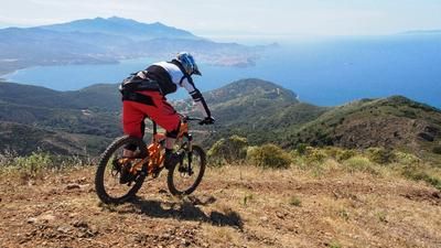
From the fishing village of Magazzini, a paved mountain road winds its way under the ruins of the old defensive fortress of Castello Volterraio up to the crest of the hill. At the Le Panche pass, turn onto the marked GTE and soon push your bike along the wide but steep gravel path to the first antenna crest. The bare mountain ridge already offers a clear view here and then forces you out of the saddle again on the last scree-strewn ramp. Finally, you reach the summit of the Cima del Monte (515 meters above sea level) - the guardian of the northern ridge. Here you have a wonderful view in all directions.
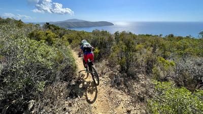
The panoramic descent starts on a flat grassy ridge with an easy roll-in, before steep slate slabs and loose scree are used up. Before the next dip, you leave the GTE onto a shady shepherd's path with fun berms on forest soil with good grip. From the next crossroads, the Bandit Trail shows its teeth: the earthy path has already suffered somewhat and the bikers trick their way downhill through slippery crossings and washed-out gullies. In the following stream bed, the toughest passages are mitigated with wooden footbridges and the trail ends more easily again in Valle Mulini. On not too steep gravel paths, the route climbs again to Colle alla Anime, an old artillery position from the Second World War with the best view over the wide Gulf of Portoferraio, where the last winding trail runs through the forest down to Magazzini. You can end the trail tour right by the marina at the excellent Mare restaurant, for example.
Map & GPX-Track
The map is only available to Ride subscribers.
The Ride-Subscription is available at ride-mtb.com/abo
.
Details of the tour
11 km
540 m
540 m
1 above sea level
508 above sea level
1 day
Magazzini
Magazzini
2573
limited
More information
No options along the route; various options in Magazzini
More tours nearby





User comments (0)
Note: This content has been automatically translated from German. Please report any incorrect translations.