

Col des Seigneurs (Alta Via del Sale)
Description
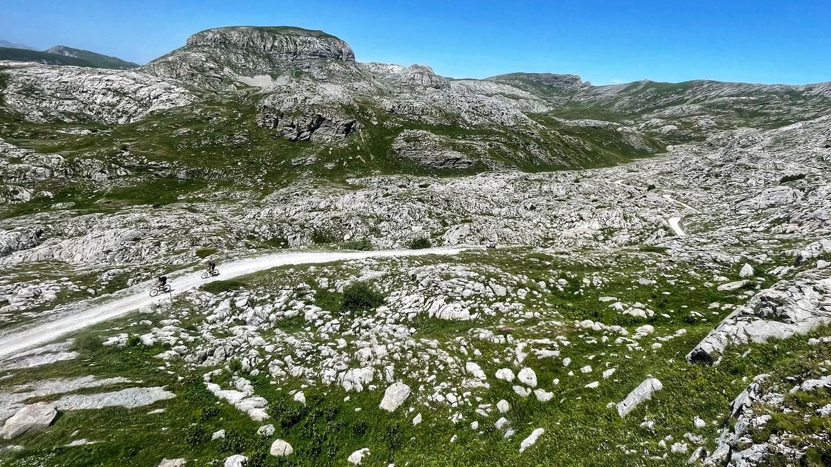
Start the tour in Tende and ride up the main road to the Col de Tende. Here you have the option of taking a bike shuttle to complete the ascent. Now continue along military roads (Alta Via del Sale) into the ski area of Limone Piemonte, where you are always over 2000 meters above sea level. Up and down, the twenty kilometers seem very entertaining, because you are amazed by the gigantic mountain world. At the end, you reach the Col des Seigneurs (Colle del Lago dei Signori). Just below is the Rifugio Barbera, where you can spend the night or at least stop for a bite to eat before the trail adventure begins.
For the descent, take the almost unrecognizable hiking trail towards Refrei, Castel Tournou. The small path is interspersed with many rocks and requires attention. The lonely mountain world is beautiful. Past a mountain pasture, keep to the right and climb a little, the trail becomes a little more flowy, but there are also some steep, blocked steps. Above the Refrei stream, the route then goes quite quickly until you turn into a spectacular, steep and rocky trail below Castel Tournou. The scenery and riding technique here are truly spectacular. Very demanding - especially after the long day - the route leads over countless loose slate slabs and hairpin bends, directly to Granges de la Pia and from here back to Tende on gravel and tarred roads. The difficulty level of the trails is S3 to S4.
Tip: If you want to shorten the ascent in the summer months, take the train to Limone Piemonte and take the Bottero cable car up to Via del Sale.
Map & GPX-Track
The map is only available to Ride subscribers.
The Ride-Subscription is available at ride-mtb.com/abo
.
Details of the tour
48 km
1730 m
1730 m
814 above sea level
2238 above sea level
1 day
La Brigue
La Brigue
2663
well suited
More information
More tours nearby


User comments (2)
Background to Ride MTB
Ride MTB is dedicated to mountain biking. With the maps Ride Trail Maps and Trail Books and the print magazine Ride, it has played a formative role in alpine mountain biking for many years and has shaped it like few other organizations.
In addition to the publishing business, the company is now also active in product management and operating entire mountain bike projects. These include the tourism project Ride Travel and the development of modern and authentic mountain bike offers such as the Bahnentour in Davos Klosters, Engadin St. Moritz, Lenzerheide or Aletsch, as well as the creation of multi-day tours such as the Postauto-Tour or the Hüttentour.
Ride MTB GmbH was founded in 2001 (formerly Swiss Sports Publishing GmbH) and has been owned and managed by Thomas Giger since then.
Publishing and editorial address
Ride MTB GmbH
Falladagasse 11
CH-7212 Seewis
+41 81 413 43 43
info@ride-mtb.com
Subscription management
Advertisements
Administration
Bank details: Graubündner Kantonalbank.
CHF account. IBAN: CH86 0077 4010 2958 8310 1, BIC: GRKBCH2270A
EUR account. IBAN: CH32 0077 4010 2958 8310 3, BIC: GRKBCH2270A
Company identification number (UID): CHE-102.170.292
The brains behind Ride MTB









Note: This content has been automatically translated from German. Please report any incorrect translations.
The old road to Col de Tende is currently (August 2026) closed due to construction in the south. Alternatively, take Tour #2665 or push your bike for 30 minutes to Asila Arnaldi at WW362 (about 1 kilometer before the construction site), then turn right at the first intersection and head west uphill (follow the “Riviera Bike” signs).
The tour is not feasible. The military road from the tunnel portal is closed or barricaded. Alternative see last section "Tip to shorten the tour".