

Mont Agnelino
Description
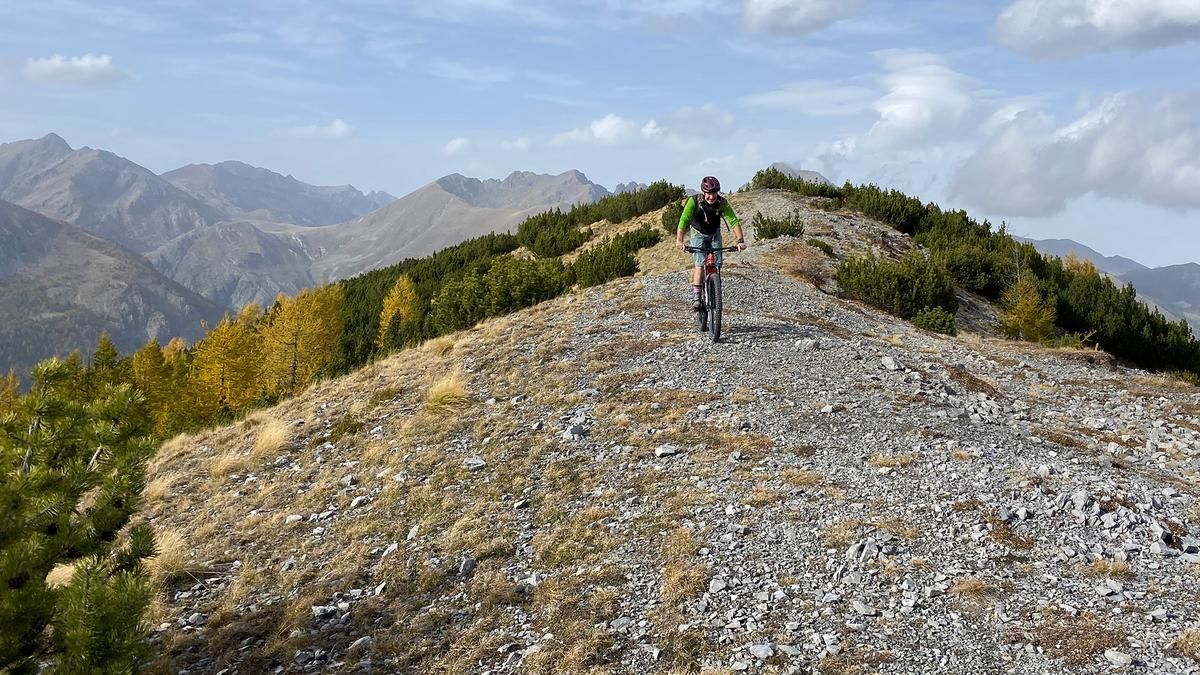
The tour starts in Saint-Dalmas-de-Tende and rolls along the road to Tende. This is where the very long climb begins, first on tarmac, then on gravel. The climb to the summit of Mont Agnelino is not particularly steep. Always stay on the "Baisse de Peyrefique". 200 meters below the summit, leave the Baisse de Peyrefigue and turn left. The ascent to the summit is a little steeper, but the effort is worth it, as the view of the Vallée des Merveilles and the Mercantour Nature Park is magnificent. The descent begins directly from the summit. In the first part, the enduro motorcycles have cut deep furrows in the trail and you have to find your line. On the opposite slope, you ride the trail to the left into the forest. There are no more motorcycle tracks here. Soon countless serpentines follow, not too difficult, down a meadow slope. At Colle Megiana, ride to the right across the alpine meadows. In the lower part, keep left until the forest begins. Here you come across a dream trail, very fast and varied on a wonderful forest floor. You continue like this for a few kilometers until you reach the "Piste de la Spegi" trail. Here it gets a little rockier, but still mostly forest floor and flowing, fast turns. At the end, you come to the Baisse de Peyrefique and ride along it for a few more bends until you take the small Chemin de Bois path on the right. Now it gets rocky and technical. There are a few tricky rocky sections to climb. After a while, you come to a small T-junction. Keep left and the downhill begins. The trail descends steeply to Saint-Dalmas-de-Tende with many hairpin bends in rocky terrain, some of which are exposed.
Map & GPX-Track
The map is only available to Ride subscribers.
The Ride-Subscription is available at ride-mtb.com/abo
.
Details of the tour
30 km
1585 m
1585 m
726 above sea level
2177 above sea level
1 day
Saint-Dalmas-de-Tende
Saint-Dalmas-de-Tende
2665
well suited
More information
More tours nearby


User comments (1)
Background to Ride MTB
Ride MTB is dedicated to mountain biking. With the maps Ride Trail Maps and Trail Books and the print magazine Ride, it has played a formative role in alpine mountain biking for many years and has shaped it like few other organizations.
In addition to the publishing business, the company is now also active in product management and operating entire mountain bike projects. These include the tourism project Ride Travel and the development of modern and authentic mountain bike offers such as the Bahnentour in Davos Klosters, Engadin St. Moritz, Lenzerheide or Aletsch, as well as the creation of multi-day tours such as the Postauto-Tour or the Hüttentour.
Ride MTB GmbH was founded in 2001 (formerly Swiss Sports Publishing GmbH) and has been owned and managed by Thomas Giger since then.
Publishing and editorial address
Ride MTB GmbH
Falladagasse 11
CH-7212 Seewis
+41 81 413 43 43
info@ride-mtb.com
Subscription management
Advertisements
Administration
Bank details: Graubündner Kantonalbank.
CHF account. IBAN: CH86 0077 4010 2958 8310 1, BIC: GRKBCH2270A
EUR account. IBAN: CH32 0077 4010 2958 8310 3, BIC: GRKBCH2270A
Company identification number (UID): CHE-102.170.292
The brains behind Ride MTB









Note: This content has been automatically translated from German. Please report any incorrect translations.
The ascent is very demanding in terms of fitness. Ramps with 19/20% and mostly very rough (Roman path-like) and partly loose ground demand a lot of strength over a long period of time. The description above does not fit. Unless the tour was done on an e-bike and there is a lack of abstraction. With regard to the current edition of Ride: I doubt that AI would have done any worse. In general, I find this description inadequate (it would describe pretty much any other trail in the region just as well/badly).
The last 200 m are not steeper at all. On the contrary. What is also missing in the poor description: the last small ascent (after following the ascent track) has some (5-10) running passages. In addition, the trail is very exposed and extremely narrow - but technically rather easier than what came before.
The middle downhill is fantastically beautiful. Top views. Trail rarely ridden and therefore not well maintained.