

Forcella Giralba

Description
The tour starts in the small village of Giralba, west of Auronzo di Cadore. The initial section is still easy to pedal. You can easily pedal your mountain bike through chalets and small houses. But shortly afterwards, the actual ascent begins - the bike is now carried or pushed over many meters of altitude.
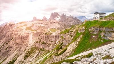
The ascent runs along an old military path that meanders evenly upwards through the rocky landscape. You soon reach an impressive mountain world that is one of the most spectacular in the entire Dolomites. Past the Rifugio Carducci, it is only a few meters up to the Forcella Giralba.
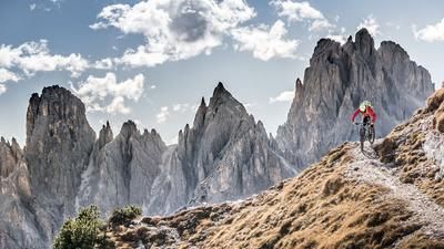
At 2430 metres above sea level, you have reached the highest point of the tour - time to take your mountain bike off your shoulder and take in the surroundings. The scenery is simply overwhelming: the Zwölferkogel rises in the west, while the Sesto Croda Rossa and its imposing neighbors tower into the sky in the north. A panorama straight out of a picture book.
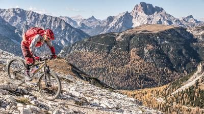
The following descent is no less impressive - and challenging. Between difficulty levels S2 and S3, with several technically challenging key sections, the trail rides steadily downhill. If you wish, you can stop off at the Rifugio Carducci along the way to recharge your batteries.
In the lower section, the trail becomes more selective, especially when crossing the Giralba river. Some passages are so challenging that the mountain bike has to be carried again for a short time. This is followed by a flowing trail that leads back to Giralba with playful bends and a grippy surface, bringing the tour to an enjoyable close.
This route is a real mountain bike mountaineering tour - ideal for anyone who wants to shoulder their bike for hours on end and be rewarded with unforgettable impressions of the landscape.
Note: The trails in this section of the Dolomites are subject to severe weather conditions in summer. Due to thunderstorms, rockfalls or erosion, the trail conditions can change rapidly, which can increase the level of technical difficulty compared to the description.
Map & GPX-Track
The map is only available to Ride subscribers.
The Ride-Subscription is available at ride-mtb.com/abo
.
Details of the tour
18 km
1470 m
1470 m
909 above sea level
2388 above sea level
Giralba
Giralba
3504
not suitable
More tours nearby



User comments (0)

About the author: Martin Depauli
Note: This content has been automatically translated from German. Please report any incorrect translations.