

Cadini-Umrundung (Drei Zinnen)

Description
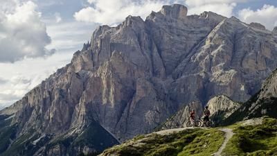
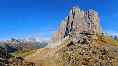
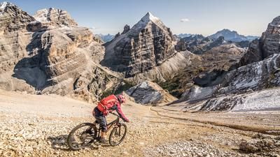
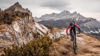
The starting point of the route is Lake Misurina at the foot of the Three Peaks. The road that leads up to the Rifugio Auronzo starts here. Please note: this is one of the most popular excursion destinations in the Dolomites, so there is a lot of traffic on this road. However, it is the only way to get to Rifugio Auronzo. The 450 vertical meters are covered relatively quickly this way. At the Rifugio, you are right at the foot of the impressive Three Peaks and follow the gravel road in the middle of the mass migration. But you only do this for just over 500 meters, then turn right onto Sentiero 1104. From one meter to the next, you are on your own again. With the panorama of the Three Peaks behind you, the focus is now on the single trail. This winds its way down the Vallon de Lavaredo in a fun and varied way. 1100 vertical meters of world-class descent!
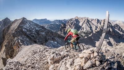
At the Cason de la Crosera, the fun is over for now - the ascent through the Val d'Onge back to Misurina follows. The gravel road winds its way up the valley, bend by bend, a steep energy guzzler of the kind you often encounter in the Dolomites. If you don't want to make the climb, roll down the Vallon de Lavaredo to the main road and order a shuttle or take the bus. The bigger experience, however, is the ascent to Forcella Maraia. This lies directly at the foot of the Cadini di Misurina, an impressive rock formation just south of the Three Peaks. The ascent covers 800 meters in altitude, but the Rifugio Città di Carpi at the top of the pass offers refreshments. Because some energy reserves are still needed. On the descent, you first roll down a gravel road, then turn onto the single trail number 120B and follow it down to Lake Misurina - a wonderful end to an extraordinary route.
Map & GPX-Track
The map is only available to Ride subscribers.
The Ride-Subscription is available at ride-mtb.com/abo
.
Details of the tour
29 km
1550 m
1550 m
1207 above sea level
2327 above sea level
1 day
Misurina
Misurina
2005
well suited
More information
Video
More tours nearby















































User comments (2)

About the author: Thomas Giger
Note: This content has been automatically translated from German. Please report any incorrect translations.
We also pushed at the top after the road, but with a 4m wide path it was almost a bit silly. The first descent was actually surprisingly easy to ride (not steep and actually only challenging because of the loose stones), but we had to cross a small stone field about 8 times and once (just before the end) we had to search for the path for longer (then deviated from the track a little), which disrupted the flow a little. Fortunately, the ascent wasn't quite as steep as I had feared, but it was a bit bumpier. In my opinion, the best view of the day at the top. Then, after the gravel road, a really nice cross-country section, which takes a lot of energy and becomes slippery and muddy when wet.
I would have given the tour a difficulty rating of 3 rather than 4. A beautiful tour with an alpine character, but one that should not be attempted because of the technical descent.
The first, quick ascent is 550 meters (not 450 meters 😉). After the Rifugio Auronzo, cycling is prohibited 🚳. We pushed our bikes the 500 meters - and everyone was happy. The view is magnificent anyway, so you shouldn't just rush past. The following downhill is great. In the lower part, the path is unfortunately difficult to ride on in some places due to bad weather. The wall path has also been rebuilt for about 500 meters. The ascent through the Val d'Onge is in good condition. The route is worthwhile - at the top of the pass, the panorama is once again first class. The singletrail 120B was exceptional fun - not very difficult (at least up to a junction), it invites you to play with your bike. At a fork (without a signpost), don't miss the path to the right - now it gets a bit more challenging again, but everything is still rideable. Super tour. Highly recommended.