

Tofana-Umrundung

Description
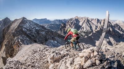
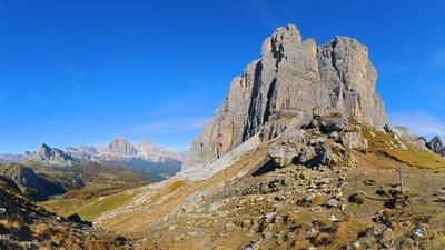
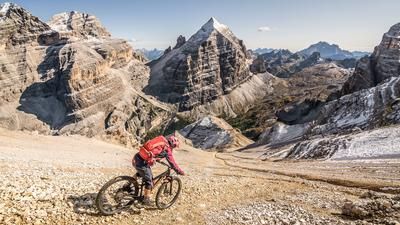
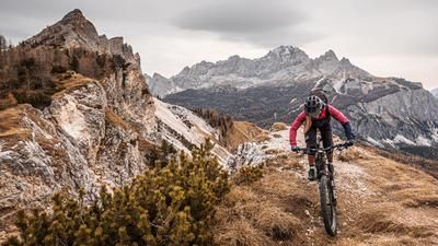
The first few meters of the tour are saved by taking the gondola ride from Cortina up to Col Drusciè. Here you head down the steep gravel road to the reservoir, then climb up a short stretch to reach the Passo Posporcora on a gravel path. The first trail begins: the descent is a fun ride down to the Fanes River, where the long climb up to the famous Fanes plateau begins. The scenic attractions in this region are extraordinary! In front of this rocky backdrop, you finally head through the lovely plateau to the Col de Locia, where the steep, technical but first-class singletrail descent down to the Alta Badia region begins. The descent ends at the pass road up to the Valparola Pass. The return journey to the Cortina region begins. You either take the road or opt for the traffic-free version on gravel roads past the Malga Valparola. From the top of the pass, you then roll over to Passo Falzarego, the starting point of the first-class descent back to Cortina. You always follow the valley floor in a mix of fast trails, challenging passages and short sections on gravel roads. You reach the Val Costean and ride unabated towards Cortina. Only the last few meters from Mortisa to the town center have to be covered on asphalt roads. Conclusion: an exceptionally impressive tour with a very high proportion of singletrack.
Map & GPX-Track
The map is only available to Ride subscribers.
The Ride-Subscription is available at ride-mtb.com/abo
.
Details of the tour
45 km
1450 m
2000 m
1197 above sea level
2199 above sea level
1 day
Cortina d’Ampezzo
Cortina d’Ampezzo
1906
well suited
More information
More tours nearby


















User comments (2)

About the author: Thomas Giger
Note: This content has been automatically translated from German. Please report any incorrect translations.
Although the stats actually match my performance, I found this hike extremely strenuous. Perhaps it’s because many of the uphill sections have loose rock (scree) as the surface. Although the scenery is beautiful (high plateau), I consider the trail portion (and thus the fun factor) insufficient for the effort required. The descent from Col da Leica can certainly be ridden technically for the most part, but the “fun trail” only starts at the Valparola Pass, which is fine.
An exceptionally scenic tour. A few comments:
- The chairlift only rides until around the end of September. Afterwards: there is a completely paved road up to the mountain station. Additional 460 vertical meters.
- The track at Ponte Alto is not correct at all. Instead of the extremely steep path straight up, it is much easier (still steep 😛) to use the little road (leading up to the left). At approx. 1675 m.a.s.l. you come back to the original track.
- From Col da Locia, the bike has to be pushed down a non-rideable rock band for approx. 200 vertical meters.