

Monte Joanaz – Cai 735

Description
The starting point of the tour is the village of Tarcetta near Fiume Natisone. From here, the route is relaxed and steadily uphill on asphalt. In the first village, Antro/Landar, there is a historic cave that is well worth a visit. The route then continues to Ialic and crosses the entire mountain towards Tamoris. This is the last major settlement before you finally pedal up the summit slope and the summit ridge. Especially from an altitude of 1000 meters above sea level, you have magnificent views of the Mediterranean and the Adriatic. The summit, at an altitude of almost 1200 meters above sea level, can be tackled as a trail uphill in the last few metres.
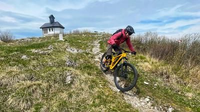
This trail is then also chosen for the descent and you follow the Sentiero Cai 753. The route leads to Montefosca on difficulty levels S2 to S3. An eternally long trail descent through beech forests and on loose rock is typical of this region. After Montefosca, take the Sentiero 735 and follow it to Stupizza. An equally long descent on the so-called Jekyll Trail. From flowing passages to partially blocked stone crossings, the full range is on offer. However, the descent is never boring. From Stupizza, you then take the less busy main road and side roads back to the starting point in a relaxed manner.
Map & GPX-Track
The map is only available to Ride subscribers.
The Ride-Subscription is available at ride-mtb.com/abo
.
Details of the tour
26 km
980 m
980 m
189 above sea level
1139 above sea level
1 day
Tarcetta
Tarcetta
2867
well suited
More information
More tours nearby






User comments (1)

About the author: Martin Depauli
Note: This content has been automatically translated from German. Please report any incorrect translations.
From Montefosca on, it's just a bumpy ride on a one-meter-wide gravel road—unfortunately, the lower section isn't really very nice.