

Sella Kriz

Description
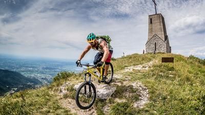
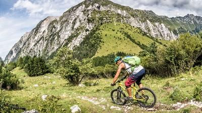
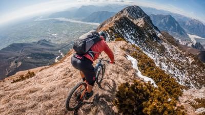
The route starts in Pradielis. From here, you roll down the main road towards Vedronza for a few meters before continuing on an idyllic side road on asphalt through Lusevera and then on to Monteaperta. An idyllic pre-Alpine region opens up, with hardly any traffic but typical Italian flair. At Monteaperta, the route briefly passes through more urban areas before entering the Muletiera Sentiero 711, the uphill that later becomes the downhill. A huge trail that starts at around 600 meters above sea level and winds its way up to an altitude of 1530 meters above sea level. In these 900 meters of altitude, you will experience one of the best Muletiera trails from the First World War. Perfectly laid out, in perfect condition and with a view that leaves nothing to be desired. It is even possible for biobikers to pedal about half of the trail uphill without any problems. E-mountain bikers clearly have the edge here and manage almost 100 percent uphill. Once you reach the saddle, the panorama is incredible. Views as far as the Triglav, Slovenia/National Park, as well as south to the Mediterranean are visible on a clear day.
The downhill is also an absolute exception. The entire 900 vertical meters uphill are surfed down. A riding experience that is unlike any other. The perfect incline, combined with the hairpin bends, offers endless downhill fun. Once you arrive in Monteaperta, you briefly take the transfer route on asphalt and then the trail switchbacks back to the starting point in Pradielis. The difficulty is in the upper range between S1 and S2. All in all, a must-do for every biker and a highlight of the Eastern Alps.
Map & GPX-Track
The map is only available to Ride subscribers.
The Ride-Subscription is available at ride-mtb.com/abo
.
Details of the tour
30 km
1330 m
1330 m
326 above sea level
1455 above sea level
1 day
Pradielis
Pradielis
2380
well suited
More information
More tours nearby


User comments (3)

About the author: Martin Depauli
Note: This content has been automatically translated from German. Please report any incorrect translations.
The entire trail ascent will be completely closed from May 25 to July 25, 2026.
+ the path gets better, even flat at the halfway point. There is a spring at the 711 start. The view is really great! The hairpin bends are not so "sharp". Locanda dall' orso is in Monteaperta. The hiking trails on the way into the Torre valley are great.
- 75% pushing is realistic, as an "E" you have to have good technique to ride through. The lower part in particular is in poor condition.
My tip: If you are riding from Tarcento on a bike, it is better to take the road to Villanova.
Our BnB is located about 20 minutes by car from the starting point of this tour and directly on the trail area of Gemona of Friuli.
https://www.bnb-bondigemona.ch/