

Muntejela de Senes

Description
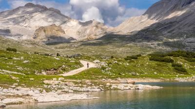
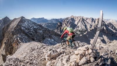
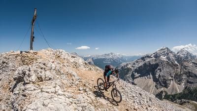
The starting point of the tour is San Vigilio, from where you wind your way up the gently ascending cycle path towards the Rautal valley to the Pederü hut. From now on, the aim is to gain altitude from the Pederü hut up to the Rifugio Fodara Vedla. The steep military road doesn't allow for any great breaks or rest periods and gives your calves no mercy. From the Rifugio, the road meanders at a lower level to the Sennes hut and then on to the Rifugio Munt de Sennes. You now reach an altitude of just under 2200 meters above sea level, from where a gentle hiking trail with a medium gradient runs up to an altitude of around 2600 meters above sea level. The trail continues to the summit of Muntejela de Senes. The hiking trail with the number 27 leaves nothing to be desired in terms of ascent and takes you directly to the summit via the shortest and most beautiful route. During the summit snack or summit break, you can get your bearings or start thinking about the next big projects in the area.
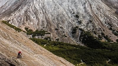
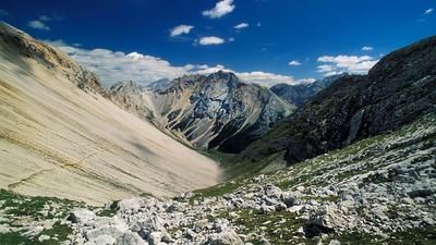
The descent follows the same route to the signpost for ascent route 24a. At an altitude of around 2500 meters above sea level, there is a crossing that leads directly to the Sennesjoch. Depending on the erosion or the condition of the trail, either take this or descend to the fork in the trail. This is up to each rider to decide at the time. An eternally long trail begins from the Sennesjoch, whereby the first few meters are more reminiscent of an alpine ski descent or the Red Bull Rampage. The surfing continues over scree fields up to an altitude of 2400 meters above sea level. From there, the trail winds its way down to S2 level into the Rautal valley. Be careful at the waterfall, where you have to push and carry your bike for a short time (only extreme experts can get through the winding sections).
In summary, an amazing tour that starts in St. Vigil and lets you ride your bike at breathtaking heights. On this tour, it is important to take enough water and snacks with you for the summit.
Map & GPX-Track
The map is only available to Ride subscribers.
The Ride-Subscription is available at ride-mtb.com/abo
.
Details of the tour
31 km
1720 m
1720 m
1 day
Sankt Vigil
Sankt Vigil
1985
not suitable
More information
Video
More tours nearby






User comments (6)

About the author: Martin Depauli
Note: This content has been automatically translated from German. Please report any incorrect translations.
The trail is officially closed! We rode the route yesterday as part of a short Dolomites crossing, coming from Cortina via the Senneshütte, without summiting. Starting at around 2,000 meters above sea level, there’s a fair amount of gravel riding that requires creative route-finding, and there are also a few trees blocking the way. The bridge is still there, though in fragments—and even beyond that, most of the trail has been washed away. Overall, it must have been a great trail at one time, and the scenery is definitely top-notch, but given the current situation, it’s not my cup of tea. Photos at: https://www.strava.com/activities/19282783837
Why does it say here that e-bikes aren't allowed? It's only at the waterfall where you have to push the bike.
Because the trail was in very poor condition at times due to bad weather—it would have been difficult with e-bikes. This was also before the era of lightweight e-MTBs :-)
Absolutely magnificent tour, all the trails were in good condition, it was also possible to ride down from the Sennesjoch and the trail down into the Rautal is really a pleasure. The unrideable sections at the waterfall hardly matter. The panorama in good weather is simply fantastic. You should fill your water bottles at the Sennes hut, after that we didn't see any more.
Update 7/22: Trail and markings restored.
I have done this tour from the Sennesjoch via "Ciastlins" several times. After the storms 2 years ago, the final bridge over the waterfall was washed away at the exit. This has since been rebuilt. However, the condition of the path last summer was no longer comparable to the one in the video. Unfortunately no more fun in 9/2021. It felt like we were on the road "forever" and, despite knowing the area, we had to keep reorienting ourselves because sometimes there was no longer a recognizable path. Unfortunately, I don't know the current condition. It's better to ask at the tourist information office in San Vigilio if it has been renovated in the meantime. The scenery is still very impressive.