

Dreifingerspitze

Description
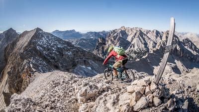
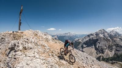
The tour starts in the center of St. Vigil and winds its way up the Val Fojedora to the Somamunt/Kreuzjoch at 2283 meters above sea level. If you've studied the Map, you'll know which route to take: it should be the easiest. The ascent to the pass is extremely steep but the scenery is very impressive. Once you reach the Joch, take the 3-path to the Dreifingerspitze at 2479 meters above sea level. The 200 vertical meters from the Joch to the summit are tackled by pushing, carrying and pedalling, although this varies depending on your fitness and riding technique. From the Hochalmsee, the mountain panorama opens up. At the summit, there is a huge 360-degree panorama, with the Alta Pusteria at your feet and the Dolomites with the Muntejela de Senes to the south.
The descent from the summit runs back to the Somamunt/Kreuzjoch on a difficulty of S1 to S2 and from there via the 24er trail to the Grünwaldjoch. Here it is important to ride on the 24/25 trail towards Val de Ciastlins and not turn off towards Grünwaldtal/Pragserwildsee. You will have to carry or push your bike for a few sections here, as you will be crossing terrain with a risk of falling for short stretches. From Monte de Gröpes at medium altitude, the trail starts to become more challenging and runs along the 25er hiking trail with a difficulty of S1 to S2 as far as Kreidefelsen. Only at the Fontane de Ciastlins waterfall do you have to take your bike down or push it for about 40 meters. There are a few valley paths that can be used as trail trimmers and you end up right back in St. Vigil where you can round off the day with a coffee and cake. Conclusion: A relatively short but very challenging tour that gives you an impression of the Sennes-Fanes region and can also be undertaken in high season.
Map & GPX-Track
The map is only available to Ride subscribers.
The Ride-Subscription is available at ride-mtb.com/abo
.
Details of the tour
23 km
1320 m
1320 m
1192 above sea level
2437 above sea level
1 day
Sankt Vigil
Sankt Vigil
2476
limited
More tours nearby


















User comments (2)

About the author: Martin Depauli
Note: This content has been automatically translated from German. Please report any incorrect translations.
Severe weather in June 2026 took a heavy toll on the trail. The trail is currently closed. On the descent down to 2,200 meters above sea level, there is no damage to the trail for the most part. Then, down to 2,000 meters above sea level, there is extensive damage to the trail; experience hiking in alpine terrain is an advantage. Between 1,800 and 1,600 meters above sea level, you’ll have to make your way through a massive moraine. You’ll see trail marks here and there. At 1,600 meters above sea level, the trail rejoins the hiking path on the right. Once you reach 1,400 meters above sea level, you’ve made it! It was still an awesome hike. I think it’ll take a while before the trail is restored—if it ever is.
According to locals, the path from Monte de Gröpes is closed after storms and is no longer passable.