

La Tavola – Val Cappone

Description
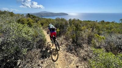
After the start in the port town of Marciana Marina, you have to climb a good 500 meters in altitude on asphalt side paths past Marciana Alta, Poggio and finally on the narrow pass road towards Passo Perone. Then you turn into the shady Sentiero, which crosses the Valle Nivera in the pine forest and rides up to the GTE path with a few stretches of pushing. The following Mulattiera, covered with large granite slabs, runs flat on the northern scree slope of Monte Capanne and is completely rideable for good bikers. You pass under the cable car and, after a short push, finally reach the downhill trail at 700 meters above sea level. From here, the bike is shouldered and you climb up the roughly paved GTE, past La Stretta, an impressive granite formation with a huge wobbly rock. After a handful of hairpin bends, you reach the saddle on Monte di Cote, where the last stretch to Caprile on La Tavola rock is rideable. Here you reach the largest chain of peaks in the Tuscan archipelago and as a biker you are at the highest trailhead on the island at 930 meters above sea level. All around, the vegetation consists of sparse garrigue in a desert of huge granite rocks.
The view in all directions is fantastic, Monte Capanne, just 1000 meters away as the crow flies, seems close enough to touch, but it is out of reach for bikers. The Via Crinale 100 to the 90-metre-higher Antenna summit is a challenging via ferrata with long stretches secured by ropes and very steep ascents and descents. From Caprile, the challenging descent trail now starts over high steps, blocked passages and, in the first section, still on solid granite. After the well-known junction, the trail in the shadow of Monte Giove then requires very good riding technique in washed-out sandy gullies and over rough boulders.
After a short stretch on the paved Via Crucis, you surf the flowing forest trail to the Cimitero, where you can take a detour to nearby Marciana Alta for a break. Back at the Cimitero, you follow a variety of trails through the old, now overgrown cultivated terraces of Val Cappone to the starting point in Marciana Marina.
Map & GPX-Track
The map is only available to Ride subscribers.
The Ride-Subscription is available at ride-mtb.com/abo
.
Details of the tour
23 km
970 m
970 m
15 above sea level
930 above sea level
1 day
Marciana Marina
Marciana Marina
2766
not suitable
More information
Various places to stop for refreshments in Marciana Alta and Poggio
More tours nearby




User comments (2)
Note: This content has been automatically translated from German. Please report any incorrect translations.
Note riding technique 5 out of 6: "the trail ... still requires very good riding technique".
For pushing/carrying passages uphill, see description,
downhill trails (also with friends) almost everything rideable, best tour to the highest bike point on Elba!
Absolutely pointless tour. Eternal pushing of the bike up through the forest because nothing is rideable.the tour makes no sense. So blocked in the descent that you have to push or carry again and again. Too bad about the time. There are certainly better trails