

Lungauer Kalkspitze – Giglachsee

Description
The starting point of the tour is just above Schladming at the Ursprungalmstrasse toll station. What is particularly interesting here is that bikers also have to buy a Map, but the profits from this system go entirely towards maintaining the area. Afterwards, you pedal leisurely into the valley on gravel and reach the Ursprungalm at an altitude of around 1600 meters above sea level. Idyllically situated and framed by the Schladminger Tauern, this is a true natural highlight. The next uphill begins as a literal highlight. It is extremely steep on gravel up to the Giglachsee hut. Here you already have a relatively good view of the Giglachsee lakes. The bike then lands on the back and is dragged up to the Lungauer Kalkspitze. The view is now particularly spectacular. The feeling of the Western Alps already arises on the ascent. At the highest point of the tour, the Lungauer Kalkspitze, you feel like a little king.
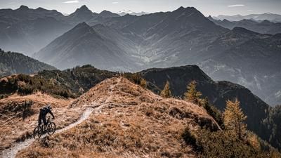
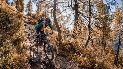
The descent is a mix of S2 to S4 in places. At the summit, you ride a ridge ride, sometimes a little exposed, then flowing again up to the Akarscharte. After that, the trail becomes increasingly difficult and there are some tricky key sections. From the Znachsattel, a bit of stumbling biking is the order of the day before finally following the old Roman path along the ascent variant to the original alpine pastures. There are also some crispy key sections here. At the Ursprungalm, you come back to the feeder road and roll back to the starting point.
Theoretically, you can also ride to the Ursprungalm by car and park it there, but the uphill to there is not really challenging and not using a car is also good for the environment. Furthermore, the tour is not recommended in summer because the area is also very popular with hikers.
Note: The route is located on Austrian territory and leads over routes that are not approved for mountain bikers. Riding this route on a mountain bike is the responsibility of each individual, in full awareness of the legal situation.
Map & GPX-Track
The map is only available to Ride subscribers.
The Ride-Subscription is available at ride-mtb.com/abo
.
Details of the tour
29 km
1335 m
1335 m
1101 above sea level
2436 above sea level
1 day
Schladming
Schladming
3143
not suitable
More information
More tours nearby



User comments (0)

About the author: Martin Depauli
Note: This content has been automatically translated from German. Please report any incorrect translations.