

Rocca di Valmiana - Nord

Description
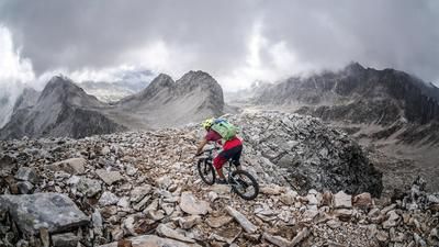
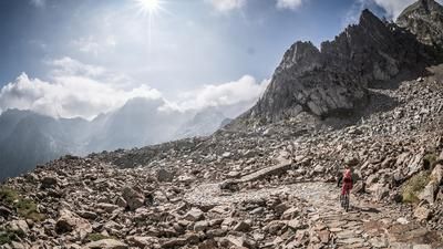
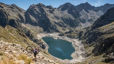
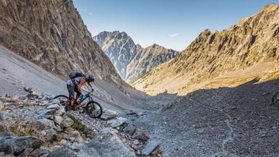
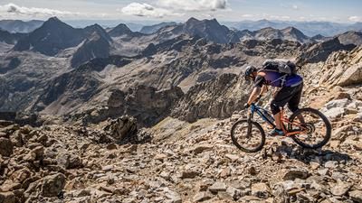
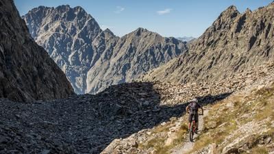
The journey begins in the small village of Sant'Anna Valdieri. A small village in the southern Western Alps, nestled in a breathtaking mountain panorama, already promises great things. Initially on asphalt, the route leads to the Terme di Valdieri. A huge complex of buildings, somewhat bizarre and somehow seemingly built in the middle of the mountains. The route then continues on an old military road in the Vallo Alpino on gravel and quite roughly uphill. A good choice of line is always required here to be able to ride the road without putting your foot down. At an altitude of around 1740 meters above sea level, pedalling comes to an end. The route then continues steadily uphill only by pushing or carrying on an Alpini path to the Colle di Valmiana crossing at over 2900 meters above sea level. A breathtaking feat of engineering was achieved here during the Second World War to be able to install a path in such areas at all. The view makes up for the strenuous climb. The views extend far over Lago del Claus, Lago inferiore di Valscura and towards Cima di Fremamorta. Once you reach the yoke itself, the air becomes thinner. The route continues to the Rocca di Valmiana summit at over 3000 meters above sea level. Ideally, you should leave your bike after the pre-summit and walk the last few meters to the summit. The summit offers a breathtaking panorama. From the town of Cuneo to the southernmost Western Alps, the view stretches from here. Countless peaks lie at your feet.
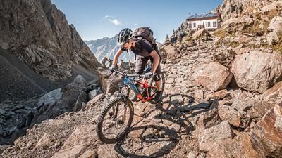
After that, the descent is just as long and technically demanding. Initially at difficulty level S2, this changes later. Constantly at difficulty S3, occasionally S4, the route heads towards Lago Soprano della Sella. A breathtaking descent that requires full concentration. The altitude, the number of hairpin bends and the difficulty of the trail demand everything from you after the already long ascent. The traverse goes up and down a little before continuing down to the meadows of Gias Gros with the same level of difficulty. Shortly above the meadows, however, a rockfall has broken off over the path and partially displaced it. A pushing section of around 50 Elevation loss must be taken into account here. From Gias Gros, the path becomes a little easier and eventually rides to Lago Sottano della Sella. A beautiful mountain lake, where you will also find the Rifugio Livio Bianco. Here the trail becomes easier again and rides back to the starting point on difficulty levels S1 to S2. An eternal descent and a never-ending trail leads downhill for kilometers on a constant gradient. A technical masterpiece to have built such paths here. Finally, it ends abruptly on asphalt directly in the village of Sant'Anna Valdieri at the starting point. All in all, one of the most intense, breathtaking and technically demanding tours in the entire region. Not to be underestimated: the 15-kilometre descent at an extremely high level. This requires physical fitness, stable weather conditions and sufficient reserves of strength.
Map & GPX-Track
The map is only available to Ride subscribers.
The Ride-Subscription is available at ride-mtb.com/abo
.
Details of the tour
33 km
1970 m
1970 m
993 above sea level
2952 above sea level
1 day
Sant'Anna Valdieri
Sant'Anna Valdieri
2630
not suitable
More information
More tours nearby





User comments (0)

About the author: Martin Depauli
Note: This content has been automatically translated from German. Please report any incorrect translations.