

Berneuse

Description
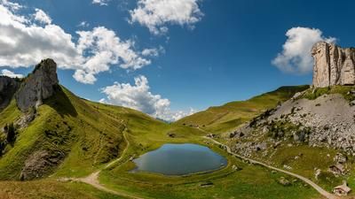
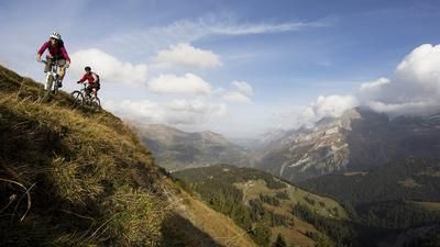
After riding the cogwheel railroad from Aigle to Leysin, you make your own way up past Lac de Mayen to the futuristic Berneuse gondola mountain station. You could also make the entire ascent by cable car, but with the 700-metre ascent, the upcoming singletrail descent to Aigle is more than worth it. This initially leads down to the Col du Lussel on a singletrail, then winds its way down the western side of the mountain flank to Alp Prafandaz. A few sections on gravel roads follow until you finally reach the center of Aigle on an agile, sometimes steep singletrail from Veyges.
Tip: Buy a day pass for the bike park in Leysin and combine the descent from Berneuse to Aigle with a few other runs on the downhill and freeride trails.
Map & GPX-Track
The map is only available to Ride subscribers.
The Ride-Subscription is available at ride-mtb.com/abo
.
Details of the tour
19 km
565 m
1560 m
405 above sea level
1954 above sea level
1 day
Leysin
Aigle VD
1682
well suited
More information
No bike hotels are registered for this region. You can register as a partner here.
More tours nearby




User comments (2)

About the author: Thomas Giger
Note: This content has been automatically translated from German. Please report any incorrect translations.
Berneuse
I rode the tour on 11.07.2022. The start of the DH just below the summit was quite fun, even if the path was almost overgrown with long grass in places. From Col de Luissel then initially quite flowy. After that, flowy, steep, rough and boring sections alternate until Drapel, but all in all it was okay. From Drapel, there is another Saane section before you spike the trail back to Aigle. As a variation, I also tried the trail directly below the Berneuse gondola. This was very difficult at first and also blocked in places, but then became easier to ride from meter to meter. An okay tour for me, nothing more.
I ride a Scott Genius Ultimate and am usually in the head group uphill; downhill I'm always the last one by a long way.
Rode up from Aigle via Corbeyrier and Boveau towards Leysin, at the end 20 min steep pushing and partly slippery, not easy.....Then descended from the military cemetery at 1216m. Very nice descent, not as steep as the map suggests, partly loose rock, but also a wonderful hollow path, all easily doable. Then it goes below the climbing rocks of Yvorne on the slope, there must be balanced, but little exposed and again very nice. Then we went back up to Boveau and rode the lower part of the descent from Lac d'Ai to Aigle, a bit slippery along the river, also very nice.