

Pointe de Bellevue

Description
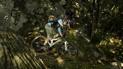
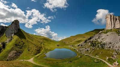
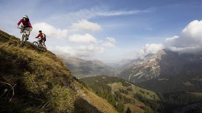
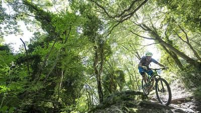
The ascent from Monthey to the foot of the Pointe de Bellevue is arduous because it feels endless, but rides almost continuously on well-maintained gravel roads. It is also possible to shorten this first section by taking the train to Troistorrent and then the post bus to Morgins. In this way, the tour is shortened by 850 meters of ascent. This shortened version is definitely worth considering, especially as the ascent from Morgins is still a tough one. It leads up to the Pâturage de Chanso on a small road and then up to the summit of the Pointe de Bellevue on a singletrail. The bike has to be pushed here. The summit impresses with its wonderful view over to the Dents du Midi before the crisp descent begins. The first section is fast and flowing down to Portes de Culet, followed by a rough singletrail into the Combe de Dreveneuse. The long singletrail descent that follows through the steep terrain down into the Rhone Valley is spectacular and varied. Tight hairpin bends alternate with fast passages, and in a few places the bike has to be pushed a few meters before winding through the forest again. The descent is seemingly endless. The further down you get, the smoother the trail becomes. The descent continues in this style until you reach the first houses of Muraz, a suburb of Monthey. It is then only a stone's throw back to the starting point at Monthey station. All in all, a tour for those who like unusual and less frequented descents with a dash of adventure.
Note: There is a direct route from the Pointe de Bellevue down to the Combe de Dreveneuse. However, this is not rideable and the bike has to be pushed down almost all the way.
Map & GPX-Track
The map is only available to Ride subscribers.
The Ride-Subscription is available at ride-mtb.com/abo
.
Details of the tour
35 km
1770 m
1770 m
389 above sea level
2023 above sea level
1 day
Monthey
Monthey
1855
limited
More information
More tours nearby




User comments (3)

About the author: Thomas Giger
Note: This content has been automatically translated from German. Please report any incorrect translations.
The entire crossing below the Pointe de Bellevue is not passable, you have to push and carry. The section from Porte de Culet is closed, you have to take the road around and approach the end of the route again. To summarize: The ascent is great, the descent is not worth it under these conditions.
We parked the car in Morgins and then pedaled up. With tight calves, everything was rideable until just below the Pointe:) We opted for the Diretissima to Dréveneuse: very steep and full of loose stones, surfing sideways was halfway okay... then tricky on the flat too, very blocked and narrow ditches... then from Dréveneuse a beautiful section of forest, also tricky, as the many roots were wet and also invited us to surf sideways... Then there were three rockfall fields to cross. The zigzag was then reasonably rideable again, although there were still some fallen trees to climb over... When you start to cross the forest path just before Muraz, it becomes smoothly rideable again... The descent also has to be fought for... If you don't like getting off your bike, you shouldn't do this tour... One rider without a bike then took the bus back to the car.
I rode the tour on July 28, 2021 and wouldn't do it again :-).
I found the climb quite entertaining and was completely rideable up to the "Pâturage de Chanso" with one exception. From there on, rideable sections alternated with pushing sections until the last 100m had to be pushed. The view from up there is truly sensational.
As described, the descent to the "Portes de Culet" is also fast and flowy and really fun, but after that the fun stops.
I wouldn't have found the start of the trail for the rest of the ride without a track, as there was nothing to see in the meadow. In the forest, the trail was then partly visible/rideable, partly also quite overgrown. After about 10 minutes, however, I decided to turn around as there was absolutely nothing left of the trail. I then took the trail to Chalet Neuf and returned to the original track at Pt. 1749. Unfortunately, this was the last rideable section for a long time. From there, the trail to the "Chaltes de Dreveneuse" was simply 90% unrideable. I would like to see the biker who can ride most of this section. I was on foot for almost an hour.
From there, it is as described again. Short flowing sections alternate with steep technical sections. The many mostly rideable hairpin bends are certainly cool. All in all, however, there are too many sections that are too difficult for my ability, I had to get off my bike again and again and there was never a feeling of flow. There were also about 3 rockfalls to cross and various trees lying across the trail. The whole downhill was a real struggle and I was glad when I arrived back at the bottom in one piece. The time also made it clear what a struggle I had today. It took me 3 hours to get to the summit, and after another 3 hours I was back at the car.
I would advise technically strong bikers to take the trail not recommended in the report from the summit directly to the "Chaltes de Dreveneuse". This is shown in black on the singletrail map and even if it is not rideable, it would still be shorter than the recommended option.
I would advise everyone else to try a different descent. There were always direct trails along the ascent route that looked perfectly rideable downhill.
I ride a Scott Genius Ultimate and am usually in the head group uphill; downhill I'm always the last one by a long way.