

Blauen Südseite

Description
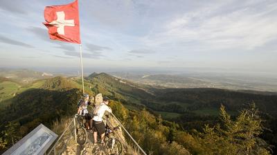
From Laufen, follow the main road to the first houses in the neighboring village of Zwingen and then turn left to Blauen. Continue uphill on an agricultural road until shortly before the Blattepass. The route continues uphill on a forest path until you finally reach the single trail on the ridge of the Blaueberg. The route now goes up and down, past the transmitter antenna to the Blauepass, on to the Brunneberg (the highest point of the tour) and finally downhill to a small road on which you climb a few meters to the Challpass. Immediately before the top of the pass, turn left to the upper end of a forest clearing, where the descent through the narrow Bachtobel ravine back to Laufen begins.
Map & GPX-Track
The map is only available to Ride subscribers.
The Ride-Subscription is available at ride-mtb.com/abo
.
Details of the tour
25 km
730 m
730 m
345 above sea level
872 above sea level
1 day
Laufen BL
Laufen BL
1079
well suited
More tours nearby


User comments (0)

About the author: Thomas Giger
Note: This content has been automatically translated from German. Please report any incorrect translations.