

Cima della Lombarda

Description
The start of this very varied tour is Isola 2000, the somewhat different extreme French tourist resort on the Italian border. From here, the route climbs moderately up the pass road to the Colle della Lombarda (2351 meters above sea level). The pass is known to many as the Tour de France stage and impresses with its beauty and solitude. From now on, the bike is shouldered and carried up the partly dilapidated path along the Italian-French border to the summit (2800 meters above sea level). At the summit, there is a small cross and a magnificent 360-degree panoramic view that is literally something to behold.
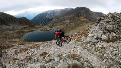
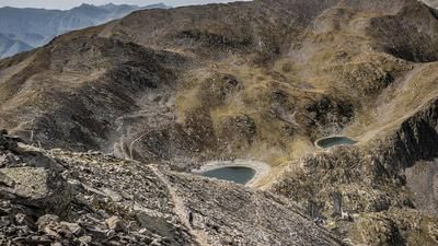
The descent to the west is also something to behold. It leads along an old, historic path, which is somewhat dilapidated in places but still exists. You wind your way past ruins up to the height of the Pas de Péania (2730 meters above sea level). From here, the route climbs a little again before tackling the next downhill section. The difficulty on this section is S3 to S4 and remains at this level for a while. At the Pas du Loup-Ouest (2665 meters above sea level) you reach French territory again and wind your way down through a breathtaking mountain panorama towards Isola 2000. In the meantime, you should always take a break and keep your eyes peeled, as there is plenty to discover between the eagles and ibexes. On the last few meters, past wonderful lakes, the difficulty remains relatively high before you dive into a shaped trail at the end and take the last few meters in a bike park back to the starting point. All in all, a short but crisp tour that is particularly worthwhile in autumn with its bombastic views.
Map & GPX-Track
The map is only available to Ride subscribers.
The Ride-Subscription is available at ride-mtb.com/abo
.
Details of the tour
13 km
765 m
765 m
2077 above sea level
2761 above sea level
1 day
Isola 2000
Isola 2000
2165
not suitable
More information
More tours nearby




User comments (0)

About the author: Martin Depauli
Note: This content has been automatically translated from German. Please report any incorrect translations.