

Testa dell'Autaret – Le Bourguet
Description
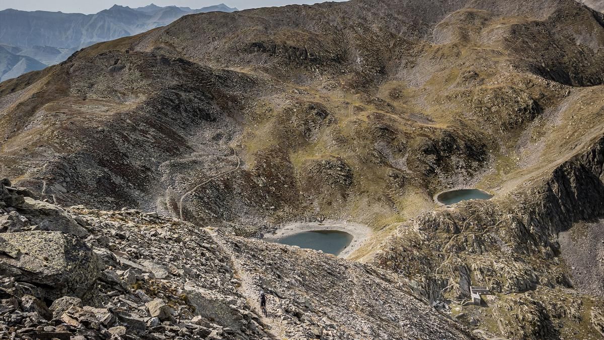
The starting point is the small French village of Le Bourguet. From here, the route continues on asphalt via Douans until the ascent road finally ends at the hamlets. After just under 400 meters in altitude, pedalling comes to an end. The remaining 1200 meters in altitude have to be covered by carrying or pushing. On a historic path, the route climbs steadily up the ridge below Roche Négre and past Téte Gerpa before finally reaching the Pas de Colle Longue. You fight your way up, metre by metre, and are presented with a view that is unique in the Maritime Alps. The absolute highlight is reached at Testa dell'Autaret.
A former military installation of the Vallo Alpino has now been completely converted into a magnificent trail descent. The descent itself is somewhat overgrown in the upper section, with difficulty levels ranging from S2 to S3. After a somewhat exposed traverse, a classic hairpin bend trail begins at difficulty level S2 and stays that way. Below the Pas de Colle Longue, the path has broken off twice during the crossing, so the bike has to be pushed here. The route then continues above the Téte Gerpa in a true flow orgy and is not really any more difficult down to Douans. After a short asphalt ride, the final trail section begins and ends in Le Bourguet.
Map & GPX-Track
The map is only available to Ride subscribers.
The Ride-Subscription is available at ride-mtb.com/abo
.
Details of the tour
23 km
1600 m
1600 m
1060 above sea level
2693 above sea level
1 day
Le Bourguet
Le Bourguet
2714
not suitable
More information
More tours nearby







User comments (0)

About the author: Martin Depauli
Note: This content has been automatically translated from German. Please report any incorrect translations.