

Combe des Geais

Description
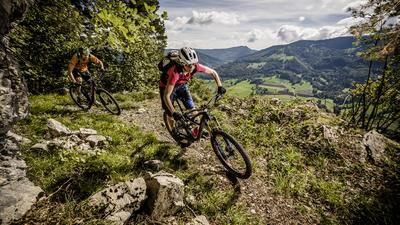
The tour begins innocuously on the road east of Moutier and rides from Eschert on country roads to Crémines and Corcelles. In the village, turn left onto the little road to Raimeux and follow it up to a kind of plateau. The road is very steep, but all paved. A little after the hamlet of Raimeux-de-Crémines, after a cow grate, a barely visible path leads off to the left across a meadow and leads to a fence passage. This is where the Supertrail begins. The first few meters are still on a tractor track, then it turns into a singletrail along the Combe de la Hue and the Combe des Geais. On a meadow, the path is no longer clearly visible and you follow the piles of stones until a little later, at the edge of the forest, the singletrail continues. Now it rides steadily downhill, initially gently and flat, then a little steeper and finally a little above Moutier, interspersed with a few tight hairpin bends. The first-class descent ends right at the edge of the village of Moutier.
Map & GPX-Track
The map is only available to Ride subscribers.
The Ride-Subscription is available at ride-mtb.com/abo
.
Details of the tour
19 km
735 m
735 m
523 above sea level
1221 above sea level
1 day
Moutier
Moutier
1247
well suited
More tours nearby


User comments (1)

About the author: Thomas Giger
Note: This content has been automatically translated from German. Please report any incorrect translations.
Did the tour in just under 3 hours. Very arduous and long ascent, fitness level 3 out of 6 is either rated too easy or I'm not fit enough. On the meadow above the edge of the forest, the GPS track is wrong (there may have been a path there), stay on the clearly visible path then it is less tedious. The serpentines are very difficult or even impossible to ride.