

Fürkelescharte

Description
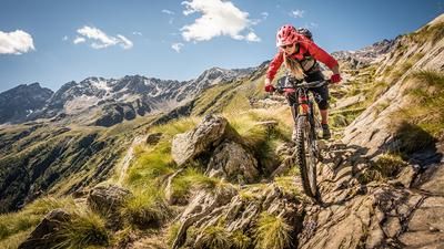
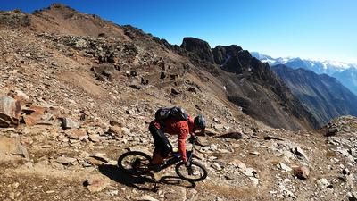
The tour starts near the tourist village of Peio above Cogolo. Along the asphalt road, the ascent to Malga Pontevecchio is leisurely. The further uphill becomes more spectacular and leads through rock faces to the Rifugio Malga Mare, where the pedaling part ends. From here, the bike is carried on the back or pushed up to the Rifugio Guido Larcher al Cevedale, while you immerse yourself in a breathtaking and scenic area. Below Monte Cevedale, the glaciers and Cima Marmotta, the trail rides up to over 3000 meters above sea level to the Fürkelescharte. The uphill ends at the saddle, and the view of the Fürkeleferner, the Martell Valley and the striking peaks of the Stelvio National Park is impressive.
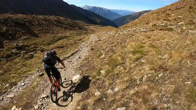
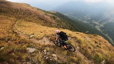
The descent is challenging, initially at S4 and S5 level in the upper section, where the bike has to be pushed a few meters. The level of difficulty then changes to S3 and S2 with some technical sections and beautiful stretches. Finally, you return to the Rifugio Guido Larcher al Cevedale and follow the ascent path downwards. The trail leads at S2, partly S1 level to the Vasca Malga Mare reservoir, then over a mostly rideable high-level trail After turning left, follow an old Mulattiera trail to the uphill section. The route then continues, mainly below Monte Vioz, on a seemingly endless mountain trail to Peio. From Peio, the final descent is relatively easy at S1 level back to the starting point. All in all, this is a gigantic tour with almost 2000 meters of ascent, suitable for fit bikers. This means you can reach the Fürkelescharte from the south side and complete it as a day tour.
This tour is particularly attractive outside the vacation season, as the number of hikers can otherwise be quite high. The crossing is also part of numerous Transalp routes by connecting the Val Martello in Val Venosta and the Val di Sole.
Map & GPX-Track
The map is only available to Ride subscribers.
The Ride-Subscription is available at ride-mtb.com/abo
.
Details of the tour
33 km
1880 m
1880 m
1195 above sea level
2958 above sea level
1 day
Cogolo
Cogolo
3177
not suitable
More information
More tours nearby





User comments (1)

About the author: Martin Depauli
Note: This content has been automatically translated from German. Please report any incorrect translations.
I rode the descent as part of the Ortler circumnavigation in July 2024. In my opinion, the ascent from the Rifugio to the Fürkelescharte from the south is not rewarding in terms of effort/yield. But it is definitely interesting as a crossing. But the descent from the hut back to Peio is great! Tip: During the descent on the high trail towards Peio towards the end of the tour, stay on the flat gravel road until a signposted path branches off to the left. This is a great singletrail addition instead of descending on the gravel road immediately after the Höhenweg. The tour could be made a little easier in terms of elevation gain by taking the gondola lift in Peio and starting the tour on the same mountain trail that is later on the descent.