

Hauenstein Kreten-Trails

Description
Following the road towards Hauenstein, you leave Olten, ride through Trimbach and take the trail parallel to the railroad line towards Hauenstein before the railroad bridge. At a small reservoir, keep slightly to the right and then keep right again to reach Hauensteinstrasse. Follow this road for around one kilometer before riding straight ahead in a hairpin bend onto the small road to Ifenthal. The route is partly steep through the village and then to Challhöchi. You continue to gain height past the hamlet of Schmutzberg, finally via a forest path, at the end of which you have to push your bike a few meters uphill.
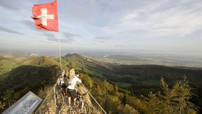
On reaching the ridge of the Ifleterberg, the racy and technically challenging descent begins in an easterly direction to the first houses on the Hauenstein. Cross the road and tackle the climb towards Froburg, from where the route continues uphill to Dottenberg. The last few meters are covered on a generally rideable but steep trail. The Kreten Trail always runs along the ridge to the east, although it is quite narrow in places and requires full concentration. The super trail ends at Wartenfels Castle and the view is well worth a short stop.
Back in the direction of Olten, the route heads uphill along forest roads to take in the southern descent of the Dottenberg and then climb back up to Froburg Castle, which you have already passed. The final descent from the Froburg castle ruins to Trimbach is particularly steep in the upper section, but becomes increasingly flowy. Finally, you roll back to the starting point in Olten on the Hauensteinstrasse.
Tip:The Jura limestone, roots and loamy forest soil typical of the area is very grippy in dry conditions, but all the more slippery in wet conditions.
Map & GPX-Track
The map is only available to Ride subscribers.
The Ride-Subscription is available at ride-mtb.com/abo
.
Details of the tour
29 km
1140 m
1140 m
391 above sea level
927 above sea level
1 day
Olten
Olten
2914
well suited
More information
More tours nearby


User comments (1)

About the author: Jonas Spöring
Note: This content has been automatically translated from German. Please report any incorrect translations.
The name says it all: a cool trail along the ridge that demands some serious riding skills. You can skip the loop at Ifleter Berg—we didn’t find it very rewarding. After that, continue on to Dottenberg and head down the ridge—it’s just awesome! Before Geissflue, it’s best to keep to the left. Then ride back toward Point 641 as soon as possible to reach Trimbach. The section near Geissflue was also challenging: lots of fallen trees and quite steep.