

Llavaneres Trails

Description
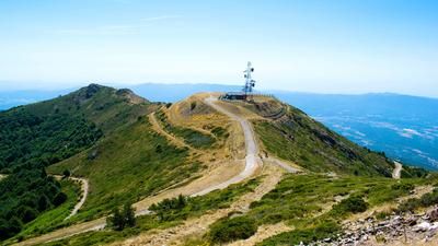
From Sant Andreu de Llavaneres, you first head up a small road to the Turo de l'Oriola. This hill with great views of the Mediterranean coast and down to the Barcelona region is the starting point for the first and later the last singletrail descent of the route. Now you head down a great S2 trail with a few S4 steps (!) to the Royal Horse Club in a valley floor. A little later, a gravel road on the typical reddish soil takes you up to Coll Pallares, sweetened in the meantime by a flowing and flat trail. The Turo de Llorita is the starting point of the next descent: it goes down to the Riera de Can Rimbles - flowy but also with bumpy sections. In the lowest part, the original trail is so heavily washed out that it has created impressive canyons several meters deep. However, these can be bypassed without any problems.
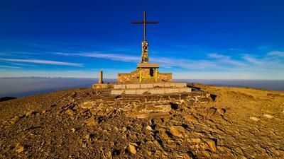
The third ascent begins at the bottom of the valley and with it the return to the coastal region. A moderately ascending road rides up to the Coll de la Ferradura. If you want, you can start the descent directly, but the detour to the Montalt summit is more rewarding. This involves a nice, short singletrail loop, but then you climb the summit on foot (the trail all the way up is difficult). Up here, you have an exceptional view of the coastal region.Back at the Coll de la Ferradura, you join the Claustra Trail. Predicate: Awesome! In the upper part, it's always in the S3 segment, but later it becomes an S2 flow. Two kilometers of ultimate trail fun! You come across a road, follow it for a few meters and then climb up a gravel road, interrupted by a short descent, to then crank up a trail to the Turo de l'Oriola (which you already know from the start of the tour). At the top, you reach a fantastic rocky landscape and the starting point of the final descent. You start on the Muffin Trail, then turn into other options and are finally "spit out" after 3.5 kilometers of perfect riding fun over a steep step onto a gravel road. Rating here too: Awesome!On local roads and finally on the main road, you roll back to the starting point in Sant Andreu de Llavaneres.
Map & GPX-Track
The map is only available to Ride subscribers.
The Ride-Subscription is available at ride-mtb.com/abo
.
Details of the tour
32 km
1095 m
1095 m
106 above sea level
573 above sea level
1 day
Sant Andreu de Llavaneres
Sant Andreu de Llavaneres
3129
well suited
More tours nearby



User comments (2)

About the author: Thomas Giger
Note: This content has been automatically translated from German. Please report any incorrect translations.
I highly recommend this tour, but keep in mind: wear a long-sleeved shirt and long pants! Some of the trails are heavily overgrown.
The trails here are really great! The first one is already completely convincing: flowing and always technically challenging. The long and exciting descent from Coll de Paietes with the steep counter-climb to Turo de l'Oriola is well worth it and is also very exciting. Instead of going back to Sant Andreu de Llavaneres, I rode down to Arenys de Mar with a short counter-climb.
The region is so cool that I had to go back a second time to discover new trails and ride the good ones again.