

Monte Croce di Ferro

Description
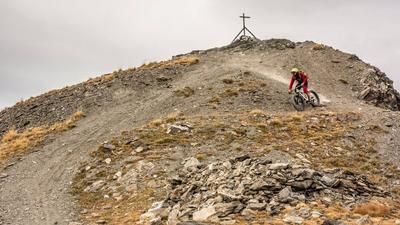
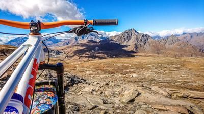
The route starts north of the historic town of Susa. From here, the uphill route winds uphill in countless hairpin bends - on asphalt, gravel and partly unpaved surfaces. Even during the ascent, magnificent panoramic views of the Cottian Alps open up. At Borgata Trucco, you reach an idyllic mountain village, but this is by no means the end of the ascent. Continue along the old military road, which crosses below the Rocciamelone, until you reach Sentiero 560. From here, there is a seemingly endless push up to the Colle della Croce di Ferro and finally to the summit of Monte Croce di Ferro. At the top, a spectacular 360-degree panorama rewards the long climb - with views of the Susa Valley, Monte Palon, Rocciamelone and the surrounding rock massifs.
The descent begins on a varied mix of S1 and S2 passages and leads downhill past the Capanna Sociale Aurelio Ravetto via the ascent route. You then reach the wide military road again, cross it and turn off in the direction of Alpe Costa Rossa. An exciting mix of S1, S2 and occasional S3 segments awaits you here. The impressive rock formations on the Rocciamelone in particular set visual accents in the upper section.
Further on, the trail remains technically varied, characterized by stony and wooded ground. Around Monte Molara, the trail becomes more demanding: short passages over rock faces and loose scree require your full attention. The challenge lies less in the condition of the trail than in the sheer length of the descent. In the lower section, you will come across a well-preserved mule track, which remains exciting to ride before you finally reach the valley floor and return to the starting point.
All in all, this is a very long and extremely demanding tour that should only be undertaken in stable weather, with sufficient fitness and in good physical condition - the uphill is more than 2,300 meters in altitude. Alternatively, you can take a shuttle to the last village of Trucco.
Map & GPX-Track
The map is only available to Ride subscribers.
The Ride-Subscription is available at ride-mtb.com/abo
.
Details of the tour
45 km
2180 m
2180 m
1 day
Susa
Susa
3554
not suitable
More information
More tours nearby






User comments (0)

About the author: Martin Depauli
Note: This content has been automatically translated from German. Please report any incorrect translations.